MyTopo
Gadsden South Carolina US Topo Map
Couldn't load pickup availability
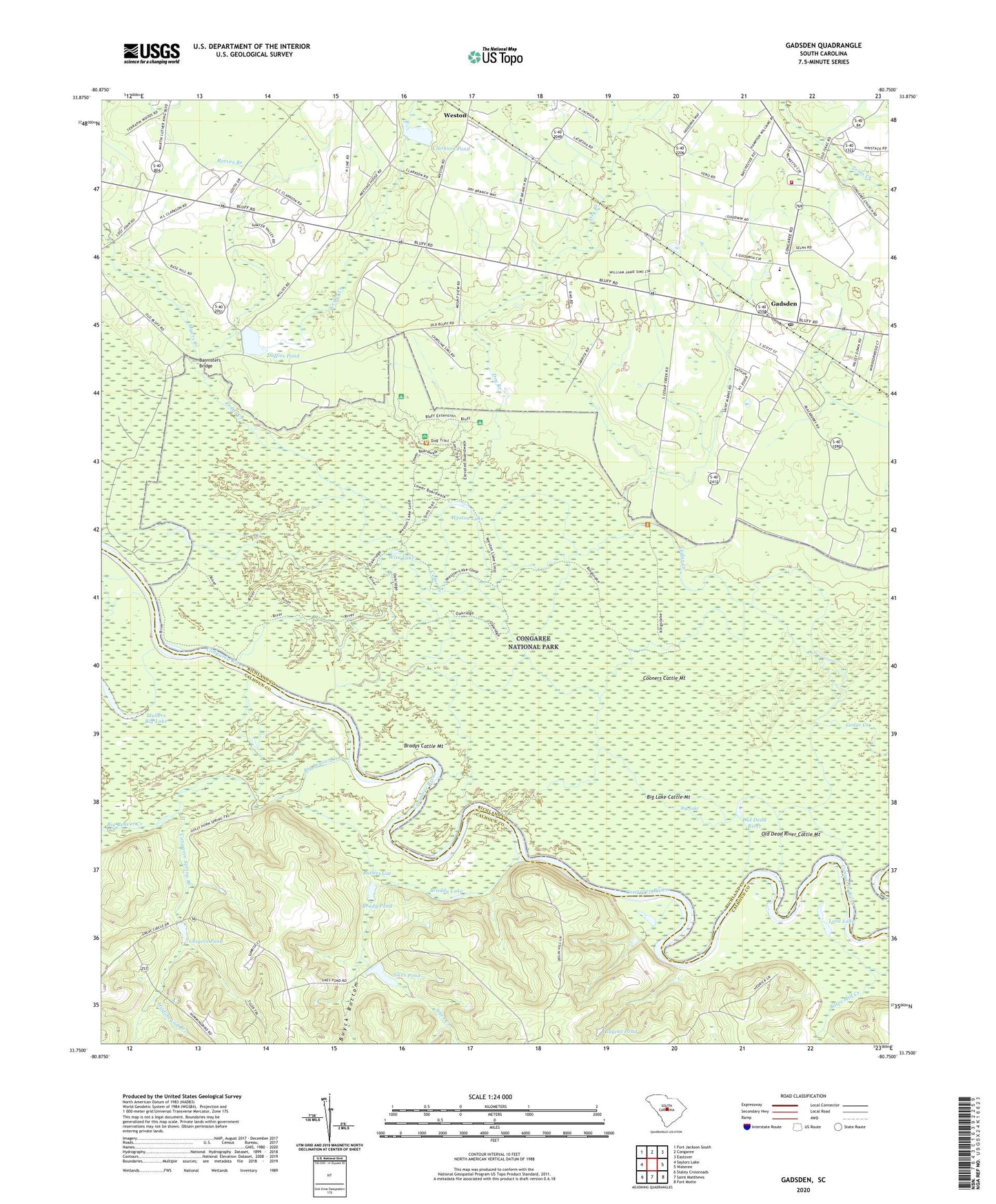
2020 topographic map quadrangle Gadsden in the state of South Carolina. Scale: 1:24000. Based on the newly updated USGS 7.5' US Topo map series, this map is in the following counties: Richland, Calhoun. The map contains contour data, water features, and other items you are used to seeing on USGS maps, but also has updated roads and other features. This is the next generation of topographic maps. Printed on high-quality waterproof paper with UV fade-resistant inks.
Quads adjacent to this one:
West: Saylors Lake
Northwest: Fort Jackson South
North: Congaree
Northeast: Eastover
East: Wateree
Southeast: Fort Motte
South: Saint Matthews
Southwest: Staley Crossroads
Contains the following named places: Bannisters Bridge, Big Beaver Creek, Big Lake, Big Lake Cattle Mount, Braddy Lake, Brady Pond, Brady Pond Dam D-2624, Bradys Cattle Mount, Butlers Gut, Buyck Bottom, Buycks Pond, Cedar Creek Hunt Club, Clarkson Pond, Clarkson Pond D-0599 Dam, Clayton School, Columbia - Richland Fire Department Gadsden, Congaree National Park Wilderness, Congaree Spring Branch, Cooners Cattle Mount, Damascus Number 2 Church, Dry Branch, Duffies Pond, Duffies Pond D-0600 Dam, Gadsden, Gadsden Census Designated Place, Gadsden Post Office, Gadsden School, Geigers Pond, Hildebrand Branch, Hopkins Division, Lord Lake, Madison Church, Mount Ararat Church, Mount Moriah Church, Mount Moriah School, Mullers Big Lake, Myers Creek, Old Dead River, Old Dead River Cattle Mount, Red Hill Church, Reeves Branch, Saint Marks Church, Saint Pauls Church, Sikes Creek, Sikes Pond, South Carolina Noname 09009 D-2622 Dam, South Carolina Noname 09010 D-2623 Dam, Weston, Weston Lake, Wise Lake, Zion Pilgrim Church