MyTopo
Wateree South Carolina US Topo Map
Couldn't load pickup availability
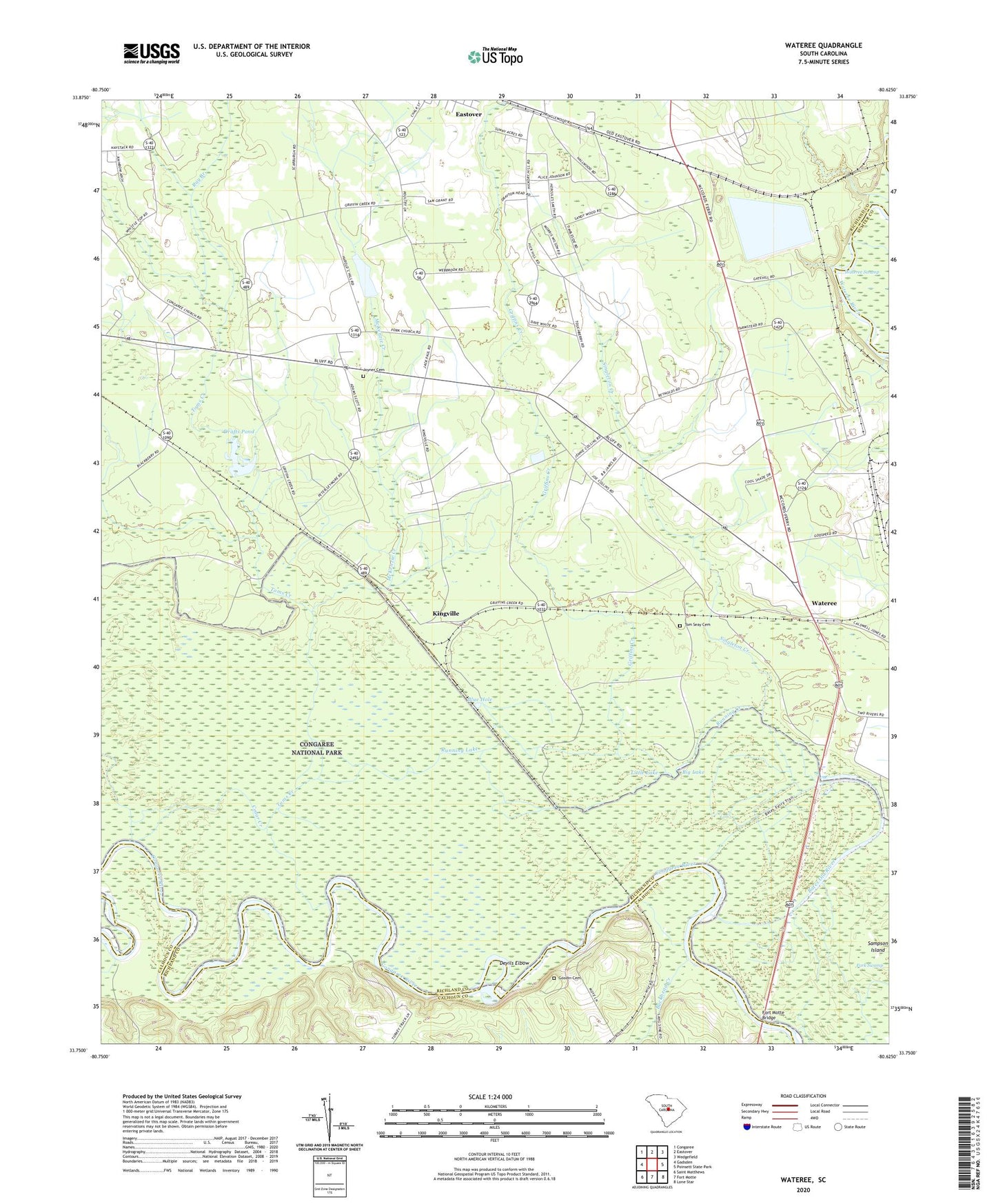
2024 topographic map quadrangle Wateree in the state of South Carolina. Scale: 1:24000. Based on the newly updated USGS 7.5' US Topo map series, this map is in the following counties: Richland, Calhoun, Sumter. The map contains contour data, water features, and other items you are used to seeing on USGS maps, but also has updated roads and other features. This is the next generation of topographic maps. Printed on high-quality waterproof paper with UV fade-resistant inks.
Quads adjacent to this one:
West: Gadsden
Northwest: Congaree
North: Eastover
Northeast: Wedgefield
East: Poinsett State Park
Southeast: Lone Star
South: Fort Motte
Southwest: Saint Matthews
This map covers the same area as the classic USGS quad with code o33080g6.
Contains the following named places: Bates Ferry, Bates Ferry Bridge, Bates Mill Creek, Bates Old River, Big Lake, Blue Hole, Buckhead Creek, Cedar Creek, Congaree Church, Congaree National Park, Cope Williams School, Devils Elbow, Drafts Pond, Fork Swamp Hunting Club, Fort Motte Bridge, Goodin Cemetery, Griffins Creek, Joyner Cemetery, Kingville, Little Lake, McKenzie Creek, Mount Nebo Church, Mount Olive Church, Pleasant Grove Church, Ray Branch, Red Hill Church, Red Hill School, Richland Church, Running Creek, Running Lake, Saint James Church, Saint Lukes Church, Saint Phillips Church, Saint Phillips School, Sampson Island, Sanctified Church, Singleton Creek, Stoney Hill Church, Stoney Hill School, Tom Seay Cemetery, Toms Creek, Wateree, Weber School, ZIP Code: 29052