MyTopo
Eastover South Carolina US Topo Map
Couldn't load pickup availability
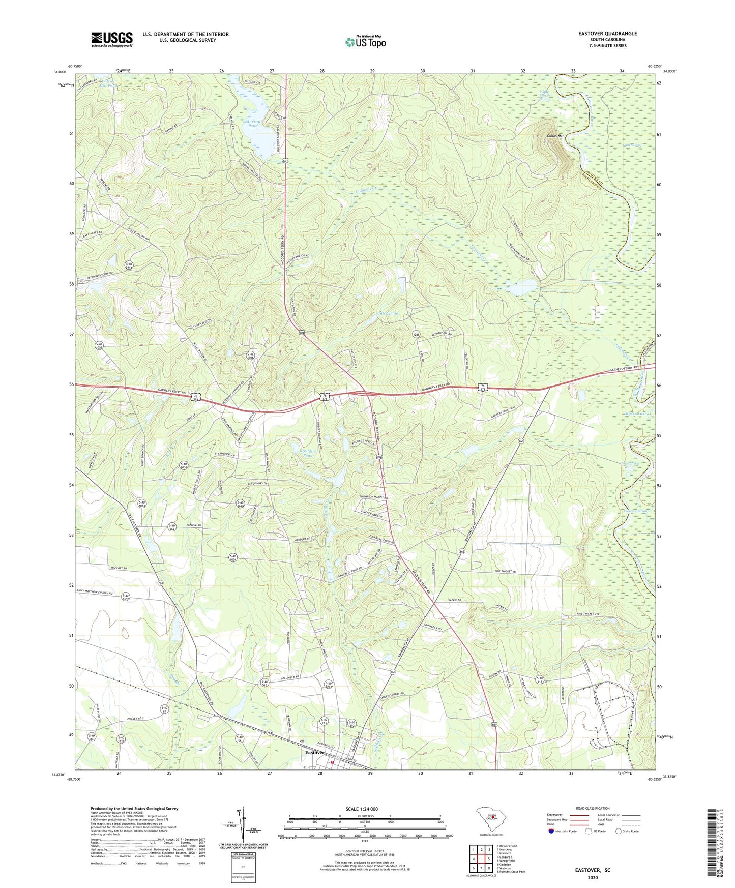
2024 topographic map quadrangle Eastover in the state of South Carolina. Scale: 1:24000. Based on the newly updated USGS 7.5' US Topo map series, this map is in the following counties: Richland, Sumter. The map contains contour data, water features, and other items you are used to seeing on USGS maps, but also has updated roads and other features. This is the next generation of topographic maps. Printed on high-quality waterproof paper with UV fade-resistant inks.
Quads adjacent to this one:
West: Congaree
Northwest: Messers Pond
North: Leesburg
Northeast: Rembert
East: Wedgefield
Southeast: Poinsett State Park
South: Wateree
Southwest: Gadsden
This map covers the same area as the classic USGS quad with code o33080h6.
Contains the following named places: Antioch Church, Antioch School, Cates Pond, Clarkson Mission Church, Colonels Creek, Columbia - Richland Fire Department Eastover, Cooks Mount, Cove Lake, Crossroad School, Crossroads Church, Daughters of Zion Church, Daughters of Zion School, Eastover, Eastover Division, Freemans Pond D-0598 Dam, Garners Ferry, Garners Quarter, Glorious Church, Good Hope Church, Goodwill Church, Goodwill Pond, Goodwill Pond D-0597 Dam, Gum Springs School, Happy Times Pond D-0596 Dam, Hickory Top Farm, Krelldire Pond, McLeod Church, Morris Pond D-0116 Dam, Mount Zion Church, Mount Zion School, Murray Lake D-0595 Dam, Murray Pond, Myers Lake, Richland Church, Richland County Chain Gang Camp Number 1, Saint Thomas Church, Shiloh Church, Shiloh School, Town of Eastover, Wateree Gun Club, Williams Lake, Wilson Mill Pond, ZIP Code: 29044