MyTopo
Galivants Ferry South Carolina US Topo Map
Couldn't load pickup availability
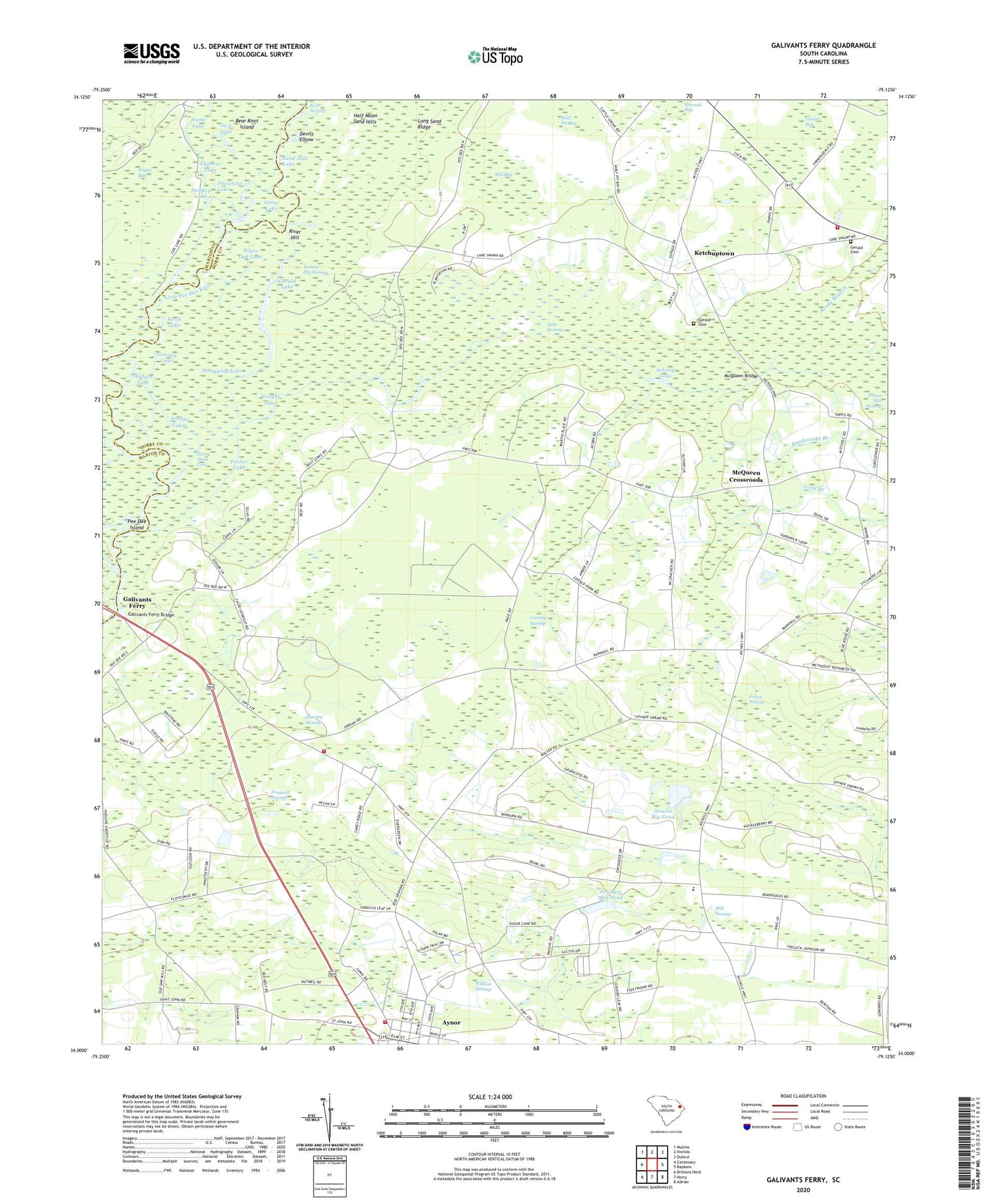
2020 topographic map quadrangle Galivants Ferry in the state of South Carolina. Scale: 1:24000. Based on the newly updated USGS 7.5' US Topo map series, this map is in the following counties: Horry, Marion. The map contains contour data, water features, and other items you are used to seeing on USGS maps, but also has updated roads and other features. This is the next generation of topographic maps. Printed on high-quality waterproof paper with UV fade-resistant inks.
Quads adjacent to this one:
West: Centenary
Northwest: Mullins
North: Nichols
Northeast: Duford
East: Bayboro
Southeast: Adrian
South: Horry
Southwest: Brittons Neck
Contains the following named places: Antioch Church, Aynor Rescue Squad, Aynor Volunteer Rescue Squad, Bass Lake, Bear Knot Island, Boggy Bay, Broad Lake, Cartwheel Landing, Chapel Hill School, Cypress Lake, Dawsey Swamp, Devils Elbow, Evans Store, Galivants Ferry, Galivants Ferry Bridge, Gator Lake, Gerald Cemetery, Gerald Gut, Gerald Lake, Gethsemane Church, Graham Mill Pond, Graham Mill Pond Dam D-3616, Granny Lake, Half Moon Sand Hills, Happy Home Church, Harry Head Cove, Hodges Lake, Home Lake, Horry County Fire Department Antioch Station 9, Horry County Fire Department Station 10, Howles Big Pond, Howles Trailer Park Pond Dam D-3618, Hughes Lake, Jack Lake, Jacks Lookout Church, Johnny Lake, Joiner Swamp, Ketchuptown, Ketchuptown Census Designated Place, Long Branch, Loosing Swamp, McQueen Bridge, McQueen Crossroads, Midland Elementary School, Mill Bay, Mill Swamp, Mill Swamp School, Moores Mill, Mount Trolly Church, New Home Church, Old Dead River, Pee Dee Island, Perch Lake, Pisgah Church, Pisgah School, Pleasant Hill School, Polecat Landing, Rattlesnake Branch, Reedy Branch, Rehoboth Church, Rehoboth School, River Hill, Rolling Hills Golf Club, Saint Johns Church, Sand Hill Lake, Sandy Plains Church, Sandy Plains School, Scrogging Lake, Smokey Lake, Snowbird Lake, South Carolina Noname 26003 D-3617 Dam, Stringy Lakes, Timber Lake, Town of Aynor, Tredwell Swamp, Trout Lake, Turkey Pen Swamp, Union Chapel School, Vaught Lake, White Oak Lake, Wildcat Swamp, Wolf Pit Bay