MyTopo
Centenary South Carolina US Topo Map
Couldn't load pickup availability
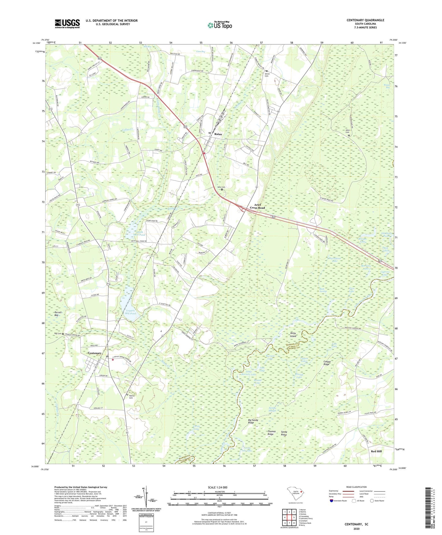
2024 topographic map quadrangle Centenary in the state of South Carolina. Scale: 1:24000. Based on the newly updated USGS 7.5' US Topo map series, this map is in the following counties: Marion, Horry. The map contains contour data, water features, and other items you are used to seeing on USGS maps, but also has updated roads and other features. This is the next generation of topographic maps. Printed on high-quality waterproof paper with UV fade-resistant inks.
Quads adjacent to this one:
West: Friendship
Northwest: Marion
North: Mullins
Northeast: Nichols
East: Galivants Ferry
Southeast: Horry
South: Brittons Neck
Southwest: Gresham
This map covers the same area as the classic USGS quad with code o34079a3.
Contains the following named places: Allen Cemetery, Ariel Church, Ariel Cross Road, Back Swamp, Barnett Lake, Baxley Farm Pond Dam D-0509, Baxley Farms, Baxleys 501 Pond Dam D-0513, Bay Cemetery, Beauty Spot School, Bee Tree Lake, Bethlehem African Methodist Episcopal Church, Bethlehem Church, Big Sandy Ridge, Blocker Lake, Cane Bay, Carey Lake, Carmichael Lake, Cartwheel Landing, Centenary, Centenary Census Designated Place, Centenary Church, Centenary Post Office, Centenary School, Centenary Volunteer Fire Department, Centerville Baptist Church, Cooper Ridge, Creek Bridge High School, Cypress Lake, Davis Landing, Deep Lake, Elvis Lake, Gallivants Ferry Church, Gurley Church, Haroldson Lake, Jack Lake, Kinney Lake, Knife Island, Knife Island Landing, Leggett Mill Pond, Leggett Millpond Dam D-0511, Little Barnett Lake, Little Reedy Creek, Liza Lake, Marion County, New Cemetery, New Faith Apostolic Church, Olivet Cemetery, Pages, Palmer Cemetery, Pee Dee Islands, Pigpen Lakes, Rain Freewill Baptist Church, Rains, Rains Census Designated Place, Rains Centenary Early Childhood Center, Rains Post Office, Rains Volunteer Fire Department, Red Hill Church, Reedy Creek, Reedy Creek Church, Round Lake, Rowell Pond Dam D-3239, Saint James African Methodist Episcopal Church, Saint James School, Saint Marys Church, Sandy Isle Lake, Sandy Ridge, Sandy Slough, Savannah Creek, Smith Mill Pond, Terrells Bay High School, The Falls, Thomas Ridge, Zion Church, Zion School, ZIP Code: 29519