
MyTopo
Gresham South Carolina US Topo Map
Couldn't load pickup availability
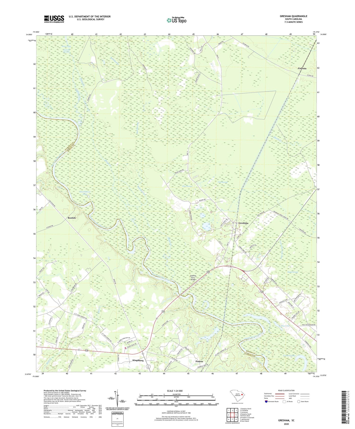
2020 topographic map quadrangle Gresham in the state of South Carolina. Scale: 1:24000. Based on the newly updated USGS 7.5' US Topo map series, this map is in the following counties: Marion, Florence. The map contains contour data, water features, and other items you are used to seeing on USGS maps, but also has updated roads and other features. This is the next generation of topographic maps. Printed on high-quality waterproof paper with UV fade-resistant inks.
Quads adjacent to this one:
West: Pamplico South
Northwest: Pamplico North
North: Friendship
Northeast: Centenary
East: Brittons Neck
Southeast: Snow Island
South: Johnsonville
Southwest: Prospect Crossroads
Contains the following named places: Allison Ferry, Bear Swamp, Big Lake, Bostick, Bostick Landing, Bostick School, Bull Swamp, Bullock Branch, Cane Swamp, Catfish Creek, Catfish Landing, Crooked Lake, Davis Landing, Daviston, Dead River, Dog Lake, Ephesus Church, Eulonia, Friendship African Methodist Episcopal Church, Friendship School, Godfrey Ferry Bridge, Godfreys Ferry, Graves Lake, Gresham, Gresham School, Hickory Hill Freewill Baptist Church, Johnsonville Fire Department Station 3, Jones Swamp, King River Pond, Kingsburg, Kingsburg Baptist Church, Kingsburg Pentecostal Holiness Church, Maple Swamp, Marion County Sheriff's Office, Mulyn Creek, Pee Dee Baptist Church, Saint Luke Church, Saint Mark School, Savage Landing, Shackleford Lake, Souls Chapel, South Carolina Noname 21010 D-3564 Dam, Stone Lake, Stone Landing, White Hill Church


