MyTopo
Pamplico North South Carolina US Topo Map
Couldn't load pickup availability
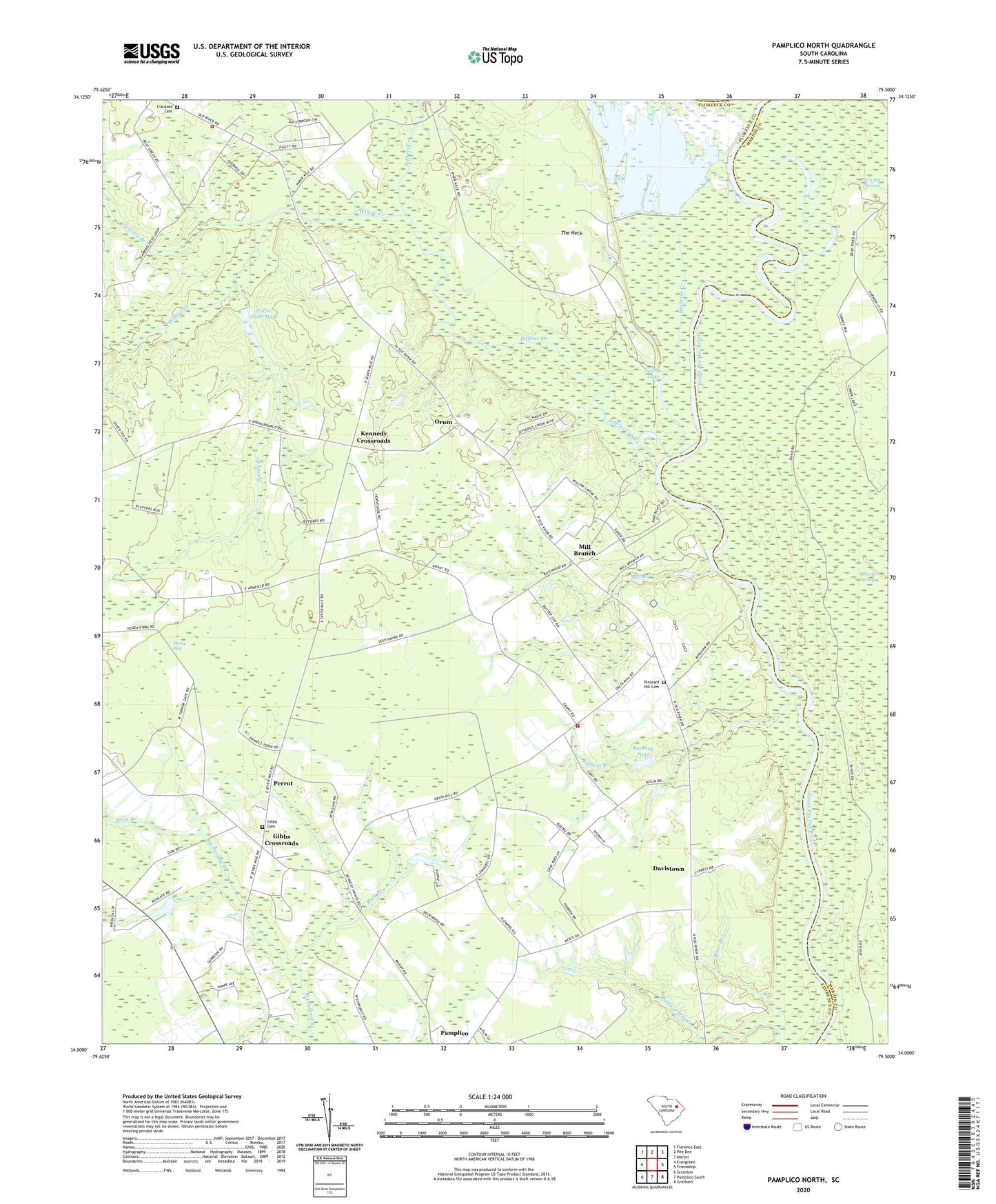
2024 topographic map quadrangle Pamplico North in the state of South Carolina. Scale: 1:24000. Based on the newly updated USGS 7.5' US Topo map series, this map is in the following counties: Florence, Marion. The map contains contour data, water features, and other items you are used to seeing on USGS maps, but also has updated roads and other features. This is the next generation of topographic maps. Printed on high-quality waterproof paper with UV fade-resistant inks.
Quads adjacent to this one:
West: Evergreen
Northwest: Florence East
North: Pee Dee
Northeast: Marion
East: Friendship
Southeast: Gresham
South: Pamplico South
Southwest: Scranton
This map covers the same area as the classic USGS quad with code o34079a5.
Contains the following named places: Bachelor Creek, Barfields Old Mill Creek, Bigham Branch, Booger Pond, Bowling Pond, Bowling Pond Dam D-3580, Brier Branch, Browns Old Mill, Buck Branch, Claussen Branch, Claussen Cemetery, Davistown, Gibbs Cemetery, Gibbs Crossroads, Gibbs School, Gum Branch, H S Hyman Pond, H S Hyman Pond Dam D-3578, Hannah - Salem - Friendfield Fire District Station 4, High Hill School, Horse Bay, Howe Springs Fire Department Station 4, Jeffries Creek, Kennedy Crossroads, Lyndhurst School, Mill Branch, Mill Branch Church, Mill Branch School, Mount Elon Church, Munns Siding, Orum, Palles Pond Dam, Pamplico Division, Pauls Plantation, Perrot, Pleasant Hill Cemetery, Pleasant Hill Methodist Church, Salem Church, South Carolina Noname 21009 D-3563 Dam, Spring Branch, Spring Branch Church, The Neck, Wateree Deer Club, Willow Creek, Willow Creek Church, WMXT-FM (Pamplico), Woodland School, Yellow Lake