MyTopo
Horry South Carolina US Topo Map
Couldn't load pickup availability
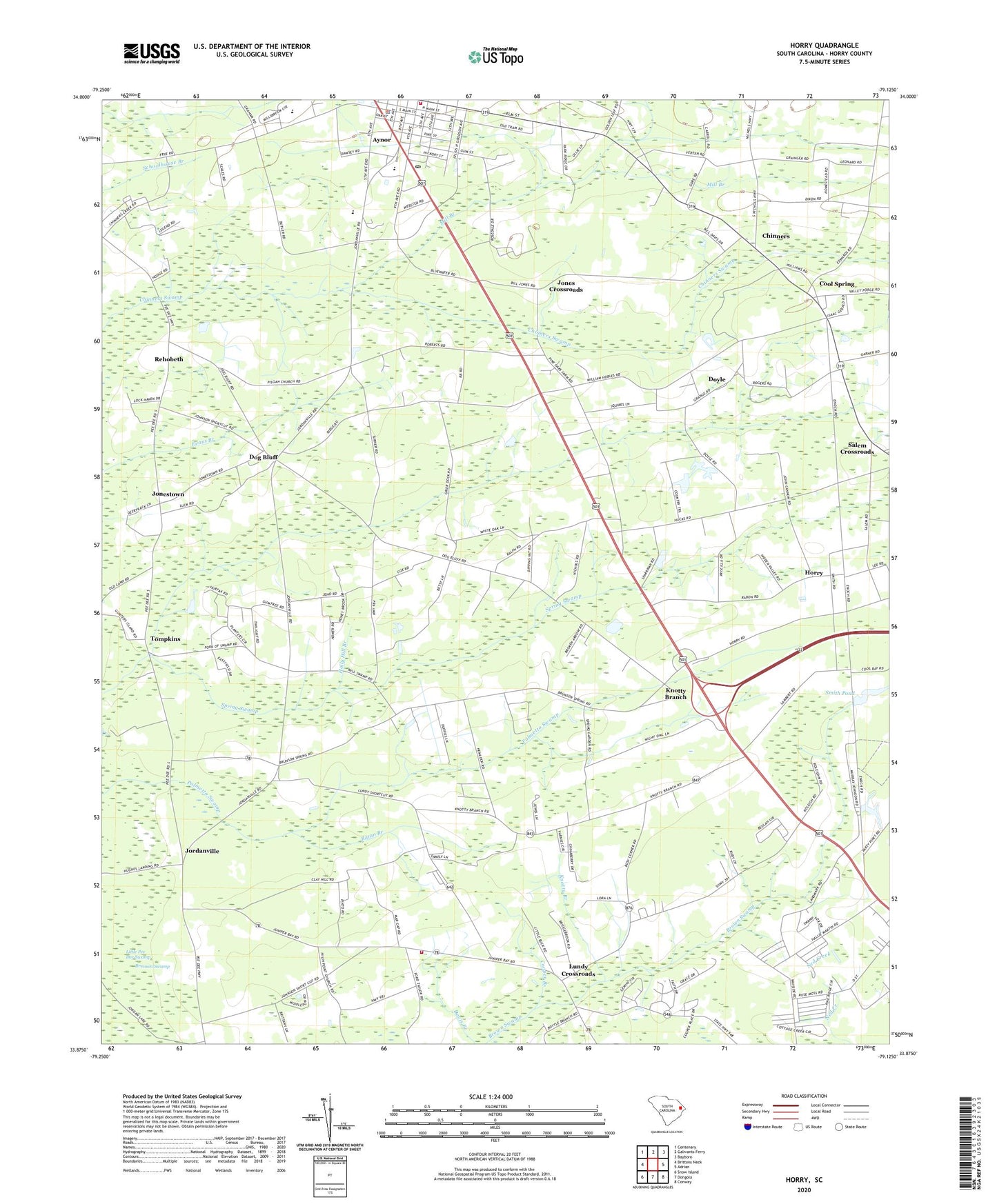
2020 topographic map quadrangle Horry in the state of South Carolina. Scale: 1:24000. Based on the newly updated USGS 7.5' US Topo map series, this map is in the following counties: Horry. The map contains contour data, water features, and other items you are used to seeing on USGS maps, but also has updated roads and other features. This is the next generation of topographic maps. Printed on high-quality waterproof paper with UV fade-resistant inks.
Quads adjacent to this one:
West: Brittons Neck
Northwest: Centenary
North: Galivants Ferry
Northeast: Bayboro
East: Adrian
Southeast: Conway
South: Dongola
Southwest: Snow Island
Contains the following named places: Aynor, Aynor Cemetery, Aynor Division, Aynor Elementary School, Aynor High School, Aynor Middle School, Aynor Police Department, Aynor Post Office, Aynor School, Bethel Church, Brown Swamp Church, Browns Swamp Church, Brunson School, Bullets Chapel, Chinners, Cool Spring, Cool Spring School, Cool Springs Southern Methodist Church, Cooper Branch, Dog Bluff, Doyle, Gideon, High Point Cemetery, High Point Church, High Point School, Holly Hill Branch, Holly Hill Church, Horry, Horry County Fire Department Aynor Station 24, Horry County Fire Department Juniper Bay, Horry County Memorial Library Aynor Branch Library, Horry Elementary School, Jones Crossroads, Jonestown, Jordanville, Jordanville Church, Knotty Branch, Little Palmetto Swamp, Lundy Crossroads, Mill Branch, Mount Herman Church, Mount Herman School, Pine Level School, Pisgah Church, Pleasant Hill, Ratan Branch, Red Hill, Rehobeth, Rehobeth Church, Rehobeth School, Rogers Fallout, Saint Elizabeth Church, Saint Matthew Church, Salem Church, Salem Crossroads, Smith Pond, Smith Pond Dam D-3621, South Carolina Noname I6039 Dam, Spring Swamp, Tompkins, Waccamaw State Designated Tribal Statistical Area