MyTopo
Lake Murray West South Carolina US Topo Map
Couldn't load pickup availability
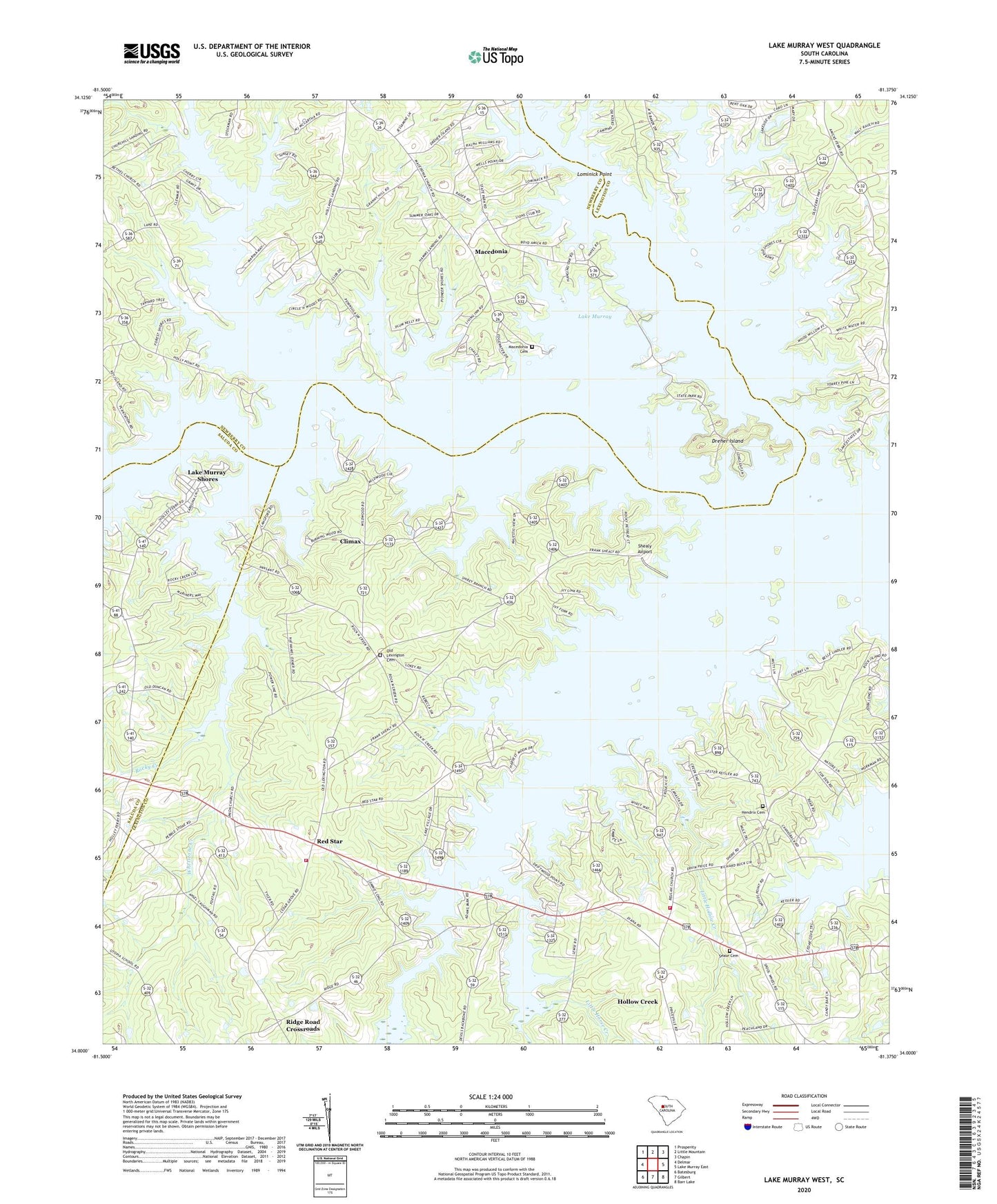
2020 topographic map quadrangle Lake Murray West in the state of South Carolina. Scale: 1:24000. Based on the newly updated USGS 7.5' US Topo map series, this map is in the following counties: Lexington, Newberry, Saluda. The map contains contour data, water features, and other items you are used to seeing on USGS maps, but also has updated roads and other features. This is the next generation of topographic maps. Printed on high-quality waterproof paper with UV fade-resistant inks.
Quads adjacent to this one:
West: Delmar
Northwest: Prosperity
North: Little Mountain
Northeast: Chapin
East: Lake Murray East
Southeast: Barr Lake
South: Gilbert
Southwest: Batesburg
Contains the following named places: Acapulco, Amicks Ferry, Beulah Church, Billy Dreher Island State Park, Buffalo Creek, Camping Creek, Climax, Climax School, Dreher Island, Ella, Good Hope Church, Hendrix Cemetery, Hollow Creek, Hollow Creek Community Center, Hollow Creek School, Hollys Ferry, Horse Creek, Jug Hole, Lake Murray, Lake Murray Shores, Lake Village, Lazy Day Acres, Lexington County Fire Service Cedar Grove Station 29, Lexington County Fire Service Hollow Creek Station 2, Little Hollow Creek, Little Horse Creek, Living Inn, Lominick Point, Longview Plant, Lowmans Crossroads, Macedonia, Macedonia Cemetery, Macedonia Lutheran Church, Mallard Bay, Milmont Shores, New Hope Church, Old Lexington Cemetery, Old Lexington Church, Oswald Park, Pineview Church, Red Star, Red Star School, Rehoboth Church, Ridge Road Crossroads, Rocky Creek, Saint Marks Church, Sease Cemetery, Shealy Airport, Snug Harbor, Union Lutheran Church, Whetstone Creek