MyTopo
Legareville South Carolina US Topo Map
Couldn't load pickup availability
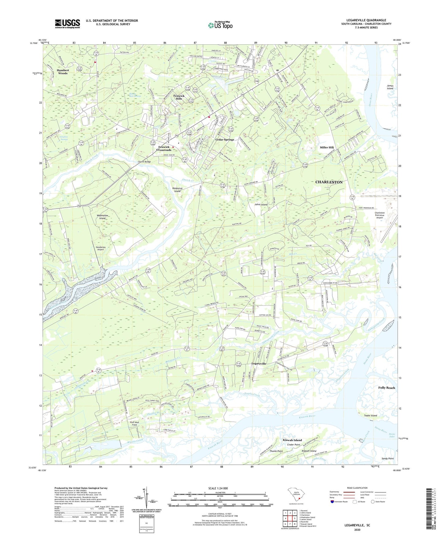
2020 topographic map quadrangle Legareville in the state of South Carolina. Scale: 1:24000. Based on the newly updated USGS 7.5' US Topo map series, this map is in the following counties: Charleston. The map contains contour data, water features, and other items you are used to seeing on USGS maps, but also has updated roads and other features. This is the next generation of topographic maps. Printed on high-quality waterproof paper with UV fade-resistant inks.
Quads adjacent to this one:
West: Wadmalaw Island
Northwest: Ravenel
North: Johns Island
Northeast: Charleston
East: James Island
Southeast: Kiawah Island OE E
South: Kiawah Island
Southwest: Rockville
Contains the following named places: Abbapoola Creek, Alligator Creek, Angel Oak Elementary School, Angel Oak Shopping Center, Bass Creek, Bethel Church, Big Oaks Hunting Club, Blessed Sacrament Church, Bloody Dick Swamp, Bugby Bridge, Burgess Road School, Calvary Church, Cedar Springs, Chaplin Creek, Charleston Collegiate School, Charleston Executive Airport, Charleston Fire Department Station 17, Church Bridge, Cinder Creek, City of Charleston Fire Department Station 17, Eden Wind Farm, Exchange Landing, Faith Church, Fenwick Crossroads, Fenwick Hills, Gaud School Playground, Green Creek, Haut Gap Middle School, Holland Island Creek, Hondarosa Airport, Hoopstick Island, Humber Wood School, Humbert Woods, Huskum Corner Cross Roads, Hut Creek, Isinglass Swamp, Johns Island, Johns Island Army Air Field, Johns Island Church, Johns Island Community Center, Johns Island Division, Johns Island Lookout Tower, Johns Island Magistrate Office, Johns Island Post Office, Kiawah River, Legareville, Legareville School, Miller Hill, Miller Hill School, Mount Zion Elementary School, Mullet Hall, Pluff Mud Field, Point Park Estates, Saint James Church, Saint Johns Church, Saint Johns Fire Department Station 1, Saint Johns Fire Department Station 5, Saint John's Fire Department Station 7, Saint John's High School, Saint Matthews Church, Saint Stephens African Methodist Episcopal Church, Sand Hill School, Seven Oaks, Shoreline Farms, Snake Island, Stafford Heights, Stono River, Stono River Stable Farm, Thumb Point, WYBB-FM (Folly Beach), Zion Church