MyTopo
Rockville South Carolina US Topo Map
Couldn't load pickup availability
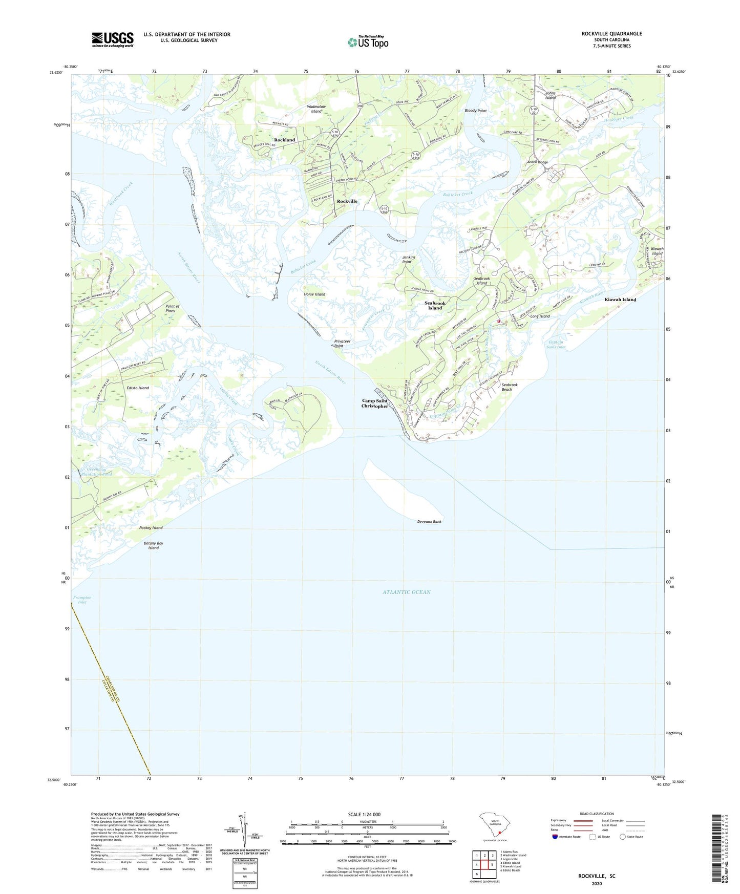
2024 topographic map quadrangle Rockville in the state of South Carolina. Scale: 1:24000. Based on the newly updated USGS 7.5' US Topo map series, this map is in the following counties: Charleston, Colleton. The map contains contour data, water features, and other items you are used to seeing on USGS maps, but also has updated roads and other features. This is the next generation of topographic maps. Printed on high-quality waterproof paper with UV fade-resistant inks.
Quads adjacent to this one:
West: Edisto Island
Northwest: Adams Run
North: Wadmalaw Island
Northeast: Legareville
East: Kiawah Island
Southwest: Edisto Beach
This map covers the same area as the classic USGS quad with code o32080e2.
Contains the following named places: Adams Creek, Andell Bridge, Bloody Point, Bohicket Creek, Bohicket Marina, Botany Bay Island, Camp Saint Christopher, Captain Sams Creek, Captain Sams Inlet, Deveaux Bank, Fickling Creek, Frampton Inlet, Grace Chapel Protestant Episcopal Church, Greenway Plantation Pond, Horse Island, Jenkins Point, Leadenwah Creek, Little Rock Church, Long Island, Middleton Lake, Middleton Lake Dam D-2559, North Edisto River, Ocella Creek, Pockoy Island, Point Farm, Point of Pines, Privateer Creek, Privateer Point, Rockland, Rockville, Rockville Historic District, Rockville Presbyterian Church, Saint Johns Church, Saint Johns Fire Department Station 2, Seabrook Beach, Seabrook Island, South Carolina Noname 10006 D-3043 Dam, South Creek, Town of Rockville, Town of Seabrook Island, Townsend River, Westbank Creek