MyTopo
Ravenel South Carolina US Topo Map
Couldn't load pickup availability
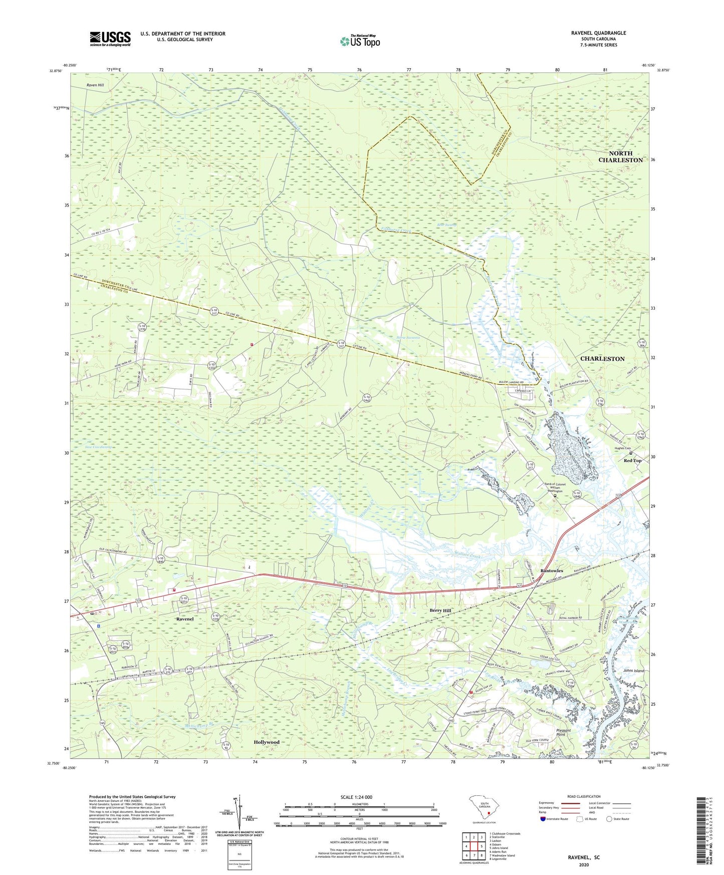
2024 topographic map quadrangle Ravenel in the state of South Carolina. Scale: 1:24000. Based on the newly updated USGS 7.5' US Topo map series, this map is in the following counties: Charleston, Dorchester. The map contains contour data, water features, and other items you are used to seeing on USGS maps, but also has updated roads and other features. This is the next generation of topographic maps. Printed on high-quality waterproof paper with UV fade-resistant inks.
Quads adjacent to this one:
West: Osborn
Northwest: Clubhouse Crossroads
North: Stallsville
Northeast: Ladson
East: Johns Island
Southeast: Legareville
South: Wadmalaw Island
Southwest: Adams Run
This map covers the same area as the classic USGS quad with code o32080g2.
Contains the following named places: Bear Swamp, Berry Hill, Bethel Church, Caw Caw Swamp, Charleston County Sheriff's Office, Davidson-Moberry School, E B Ellington Elementary School, First Baptist Church of Ravenel, Fishburne Creek, Horse Savanna, Hughes Cemetery, Jordan Missionary Baptist Church, Log Bridge Creek, Mellichamp Branch, Middle Branch, Miley Hill School, Miller School, Mount Olivet Church, New Hope Church, Pentecostal Church, Pleasant Point, Point Pleasant, Rantowles, Rantowles School, Raven Hill, Ravenel Post Office, Ravenel School, Red Hill Church, Roper Run Church, Saint Johns Church, Saint Marks Church, Saint Matthews Church, Saint Pauls Church, Saint Paul's Fire Department, Saint Paul's Fire Department Station 2, Saint Paul's Fire Department Station 4, Sauldam Baptist Church, Stono Ferry Golf Course, Tomb of Colonel William Washington, Town of Hollywood, Town of Ravenel, Wallace Creek, WMGL-FM (Ravenel)