MyTopo
Limehouse South Carolina US Topo Map
Couldn't load pickup availability
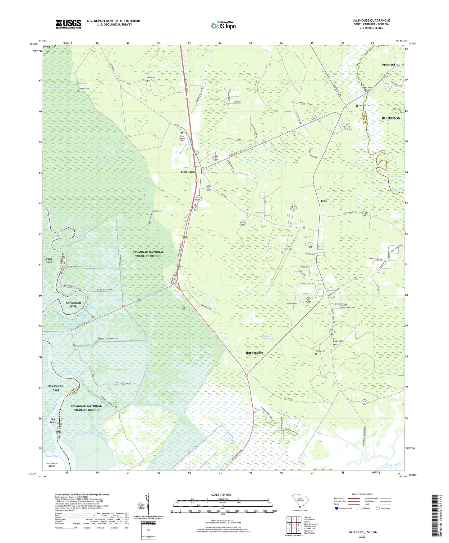
2020 topographic map quadrangle Limehouse in the states of South Carolina, Georgia. Scale: 1:24000. Based on the newly updated USGS 7.5' US Topo map series, this map is in the following counties: Jasper, Beaufort, Chatham. The map contains contour data, water features, and other items you are used to seeing on USGS maps, but also has updated roads and other features. This is the next generation of topographic maps. Printed on high-quality waterproof paper with UV fade-resistant inks.
Quads adjacent to this one:
West: Port Wentworth
Northwest: Rincon
North: Hardeeville
Northeast: Jasper
East: Pritchardville
South: Savannah
Southwest: Garden City
Contains the following named places: Allen Cemetery, Chisolm Cemetery, Clydesdale Creek, Cook Landing, Cooper Cemetery, Cross Tides, Garret Cemetery, Hardeeville Division, Hardy Cemetery, Hog Island, Jonesville Church, Levy, Levy Fire Department Station 25, Limehouse, Little Back River, Lucknow Canal, Macedonia Church, Monkey John Swamp, Mount Olive Church, Murray Hill Canal, New Garret Cemetery, New River Bridge, Parker Cemetery, Pelot Cemetery, Pritchard, Rutledges Rice Mill, Saint Mark Church, Saint Paul Church, Saint Stephens Church, Salt Water Creek, Shad School, Taylor Canal, Tunbridge Neck, Turnbridge Landing, Union Landing, Vernezobre Creek, Williams Cemetery, ZIP Code: 29927