MyTopo
Jasper South Carolina US Topo Map
Couldn't load pickup availability
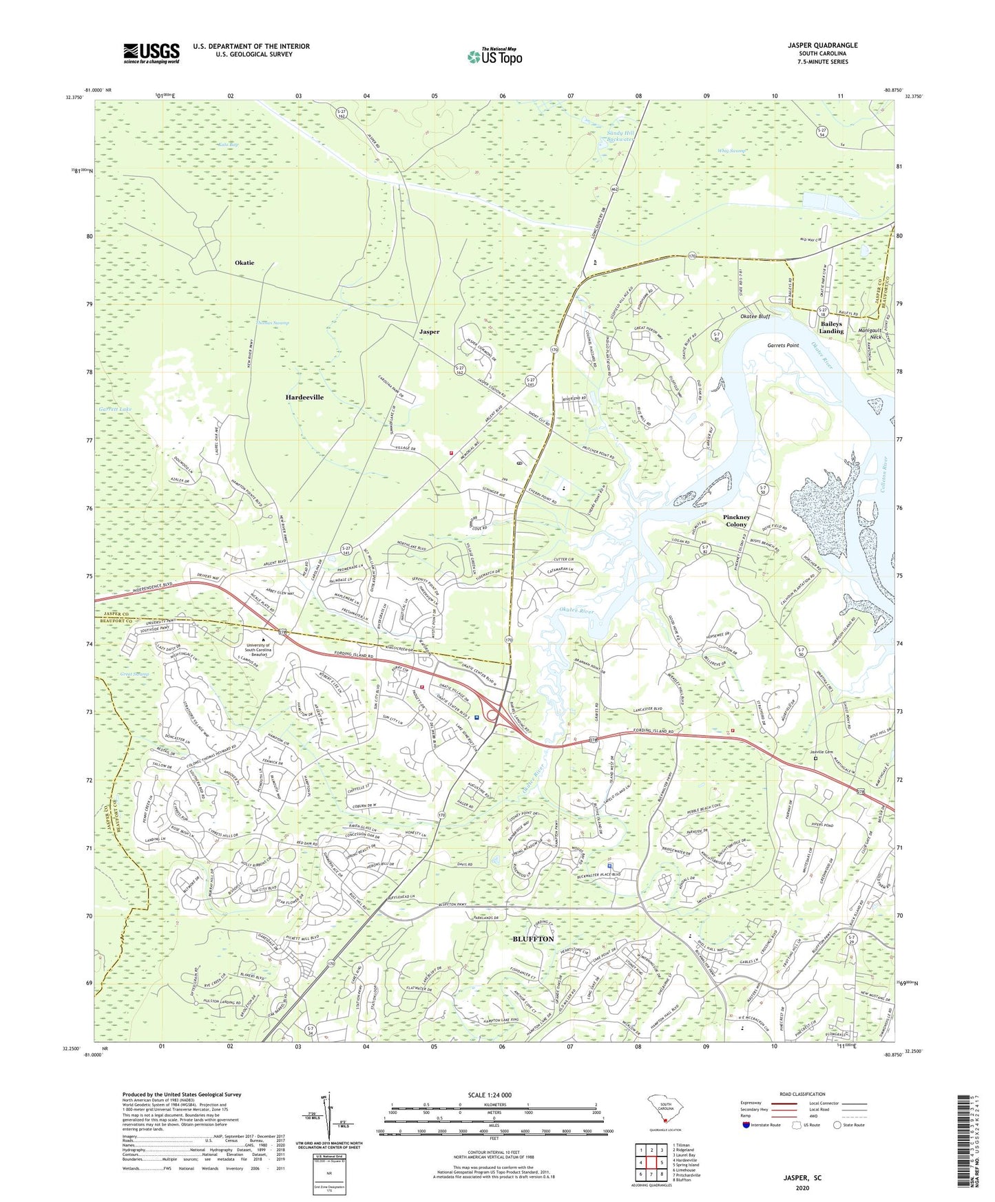
2024 topographic map quadrangle Jasper in the state of South Carolina. Scale: 1:24000. Based on the newly updated USGS 7.5' US Topo map series, this map is in the following counties: Jasper, Beaufort. The map contains contour data, water features, and other items you are used to seeing on USGS maps, but also has updated roads and other features. This is the next generation of topographic maps. Printed on high-quality waterproof paper with UV fade-resistant inks.
Quads adjacent to this one:
West: Hardeeville
Northwest: Tillman
North: Ridgeland
Northeast: Laurel Bay
East: Spring Island
Southeast: Bluffton
South: Pritchardville
Southwest: Limehouse
This map covers the same area as the classic USGS quad with code o32080c8.
Contains the following named places: Baileys Landing, Barrell Landing, Beaufort - Jasper Academy for Career Excellence, Bethlehem Baptist Church, Bluffton - Okatie Outpatient Center, Bluffton Fire Department Station 34, Bluffton Fire Department Station 35, Bluffton High School, Bluffton Police Department, Buckwalter Commons Industrial Park, Camp Saint Marys Church, Chelsea, Cherry Point Landing, Cross Episcopal School, Garrets Point, Golf Club At Rose Hill, Great Swamp, Indian Hill Church, Island West Golf Course, Jasper, Jasper County Fire Department Cherry Point, Jaxville Cemetery, Kato Bay, Middleton Swamp, New River Center for Commerce, Okatee Bluff, Okatee River, Okatie, Okatie Elementary School, Okatie Monkey Farm, Okatie School, Pinckney Colony, Rose Hill Country Club, Rose Hill Plantation, Saint Andrews Church, Saint Lukes Church, Sandy Hill Backwater, South Carolina Noname 07004 D-2932 Dam, South Carolina Noname 27008 D-2589 Dam, Sport Bridge School, Thomas Swamp, WBEU-AM (Hardeeville), Whig Swamp, WYKZ-FM (Beaufort)