MyTopo
Little Mountain South Carolina US Topo Map
Couldn't load pickup availability
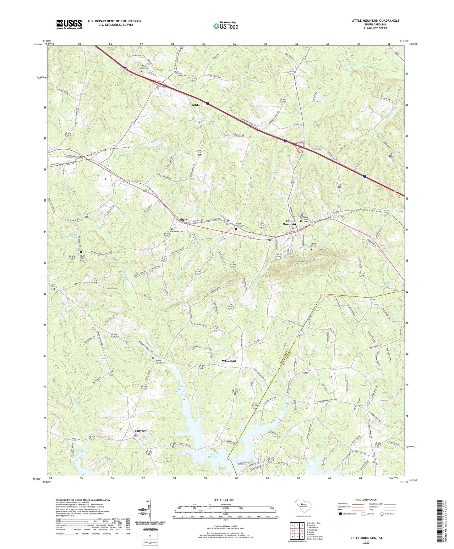
2020 topographic map quadrangle Little Mountain in the state of South Carolina. Scale: 1:24000. Based on the newly updated USGS 7.5' US Topo map series, this map is in the following counties: Newberry, Lexington. The map contains contour data, water features, and other items you are used to seeing on USGS maps, but also has updated roads and other features. This is the next generation of topographic maps. Printed on high-quality waterproof paper with UV fade-resistant inks.
Quads adjacent to this one:
West: Prosperity
Northwest: Newberry East
North: Pomaria
Northeast: Jenkinsville
East: Chapin
Southeast: Lake Murray East
South: Lake Murray West
Southwest: Delmar
Contains the following named places: Boland Crossroads, Caughman School, Eptings Pond, Eptings Pond D-1477 Dam, Fairview, Fairview Fire Department, Fairview High School, Holy Trinity Cemetery, Holy Trinity Evangelical Lutheran Church, Jollystreet, Kibler, Lexington County Fire Service Amicks Ferry Station 22, Little Mountain, Little Mountain Elementary School, Little Mountain Fire Department, Little Mountain School, Mayer Creek, Mid Carolina High School, Mid-Carolina Junior High School, Millers Branch, Mount Hebron Cemetery, Mount Hebron Church, Mount Hebron School, Mount Olive School, Mount Olivet Cemetery, Mount Olivet Lutheran Church, Mount Pilgrim Cemetery, Mount Pilgrim Lutheran Church, Mount Tabor Cemetery, Mount Tabor Lutheran Church, Mount Zion Cemetery, Mount Zion Church, Mount Zion School, Oak Grove Cemetery, Oak Grove Church, Oak Grove School, Piney Woods School, Prosperity Division, Providence Church, Providence School, Rocky Branch, Saint Pauls Cemetery, Saint Pauls Lutheran Church, Saint Peters Church, Slighs, Snap Branch, Stevens Creek, Summers Branch, Susannah Branch, Town of Little Mountain, Wheeland