MyTopo
Rion South Carolina US Topo Map
Couldn't load pickup availability
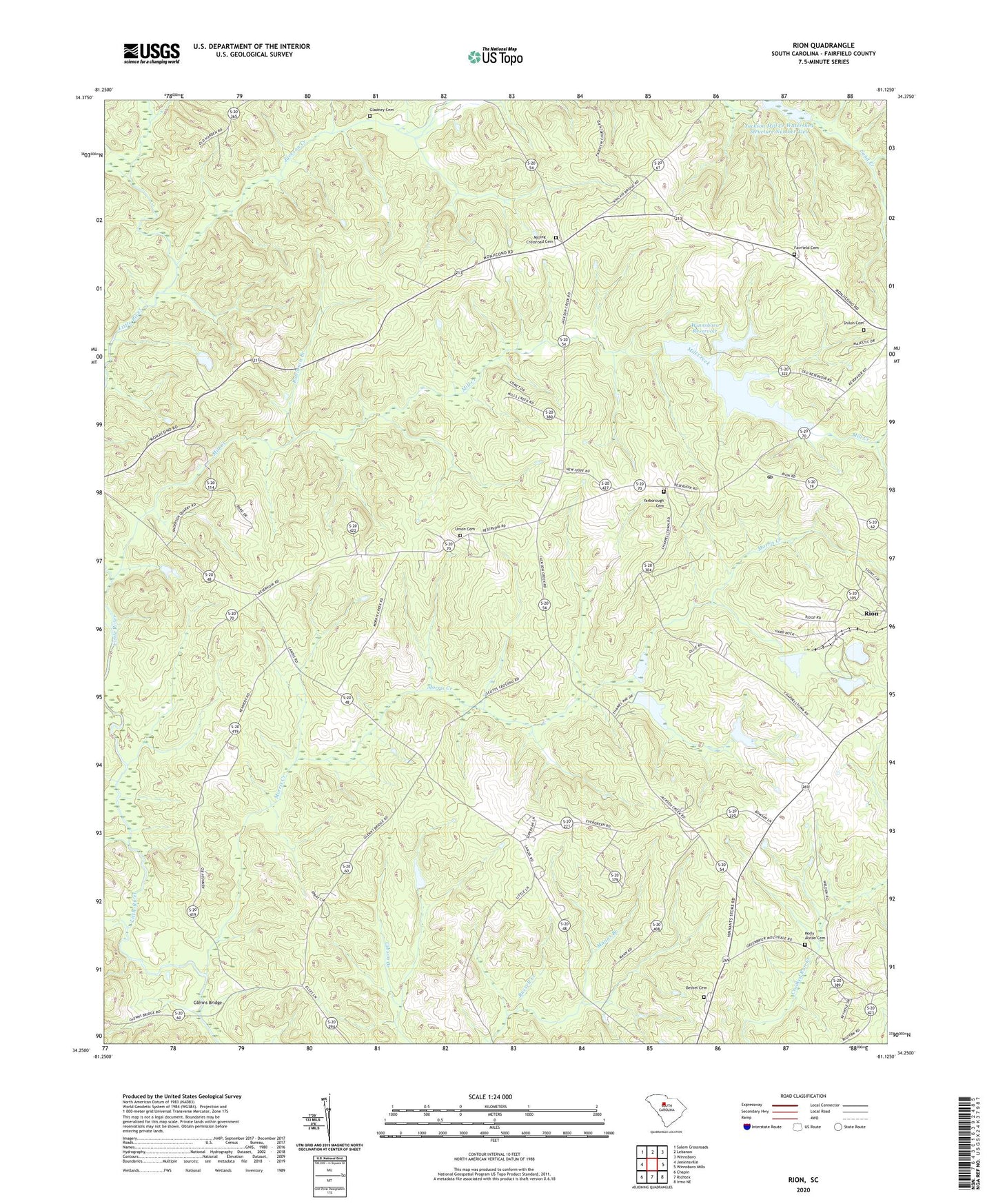
2020 topographic map quadrangle Rion in the state of South Carolina. Scale: 1:24000. Based on the newly updated USGS 7.5' US Topo map series, this map is in the following counties: Fairfield. The map contains contour data, water features, and other items you are used to seeing on USGS maps, but also has updated roads and other features. This is the next generation of topographic maps. Printed on high-quality waterproof paper with UV fade-resistant inks.
Quads adjacent to this one:
West: Jenkinsville
Northwest: Salem Crossroads
North: Lebanon
Northeast: Winnsboro
East: Winnsboro Mills
Southeast: Irmo NE
South: Richtex
Southwest: Chapin
Contains the following named places: Anderson Quarry, Bells Mill, Bethel Cemetery, Bethel Church, Bethel School, Black Jack Church, Black Jack School, Fairfield Cemetery, Fairfield Church, Fairview Church, Fairview School, Gladney Branch, Gladney Cemetery, Glenns Bridge, Harden Branch, Jackson Creek, Jackson Mill Creek Watershed Structure Number One, Jackson Mill Creek Watershed Structure Number Two, Jackson Mill Creek WCD Dam D-0523, Jackson Mill Creek WCD Dam Two D-0521, Kelly Miller School, Kincaids Mill, Macfie Pond D-1568 Dam, Mill Creek, Milling Crossroad Cemetery, Molly Alston Cemetery, Morris Creek, Morris Creek Church, Mount Zion Church, Mount Zion School, Neckleys Creek, New Hope Church, New Hope School, Rion, Robinson Branch, Russell Creek, Saint Johns Church, Saint Matthews Church, Saint Matthews School, Shiloh Cemetery, Shiloh Church, Shiloh School, South Carolina Noname 20008 D-0525 Dam, South Carolina Noname 20021 D-0438 Dam, Union Cemetery, Union Memorial Church, Union School, Winnsboro Reservoir, Winnsboro Reservoir Dam D-0522, Winnsboro South Division, Yarborough Cemetery