MyTopo
Sewee Bay South Carolina US Topo Map
Couldn't load pickup availability
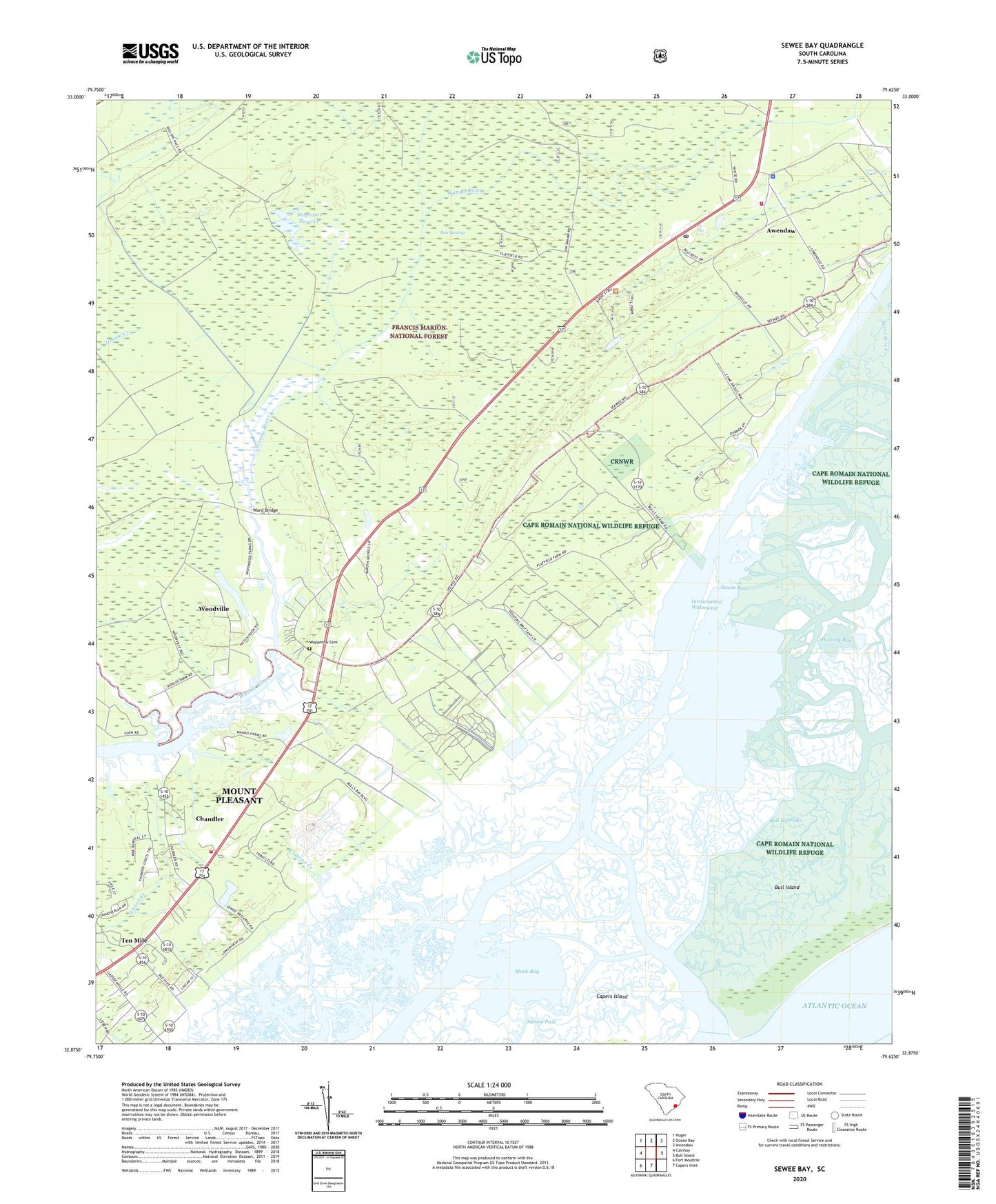
2020 topographic map quadrangle Sewee Bay in the state of South Carolina. Scale: 1:24000. Based on the newly updated USGS 7.5' US Topo map series, this map is in the following counties: Charleston, Berkeley. The map contains contour data, water features, and other items you are used to seeing on USGS maps, but also has updated roads and other features. This is the next generation of topographic maps. Printed on high-quality waterproof paper with UV fade-resistant inks.
Quads adjacent to this one:
West: Cainhoy
Northwest: Huger
North: Ocean Bay
Northeast: Awendaw
East: Bull Island
South: Capers Inlet
Southwest: Fort Moultrie
Contains the following named places: Alston Creek, Awendaw Church, Awendaw Fire District Station 1, Awendaw Fire District Station 2, Awendaw Post Office, Awendaw School, Awendaw Sheriff's Department, Back Creek, Bull Narrows, Chandler, Charleston County Sheriff's Office Substation, Clauson Creek, Deer Creek Farm, Hickory Bay, I'on Swamp, Mark Bay, Mayrants Reserve, Moores Landing, Nebo Church, Santee Pass, Santo Sotille Ranch, Schooner Creek, Sewee Bay, Sewee Church, Ten Mile, Town of Awendaw, Twelve Mile School, Twenty One Mile School, Wappetaw Independent Congregational Church, Wappetow Cemetery, Ward Bridge, WAVF-FM (Hanahan), WCBD-TV (Charleston), WCIV-TV (Charleston), WCSC-TV (Charleston), WITV-TV (Charleston), Woodville, WSCI-FM (Charleston), WTAT-TV (Charleston), WXTC-FM (Charleston), Zion Church, ZIP Code: 29429