MyTopo
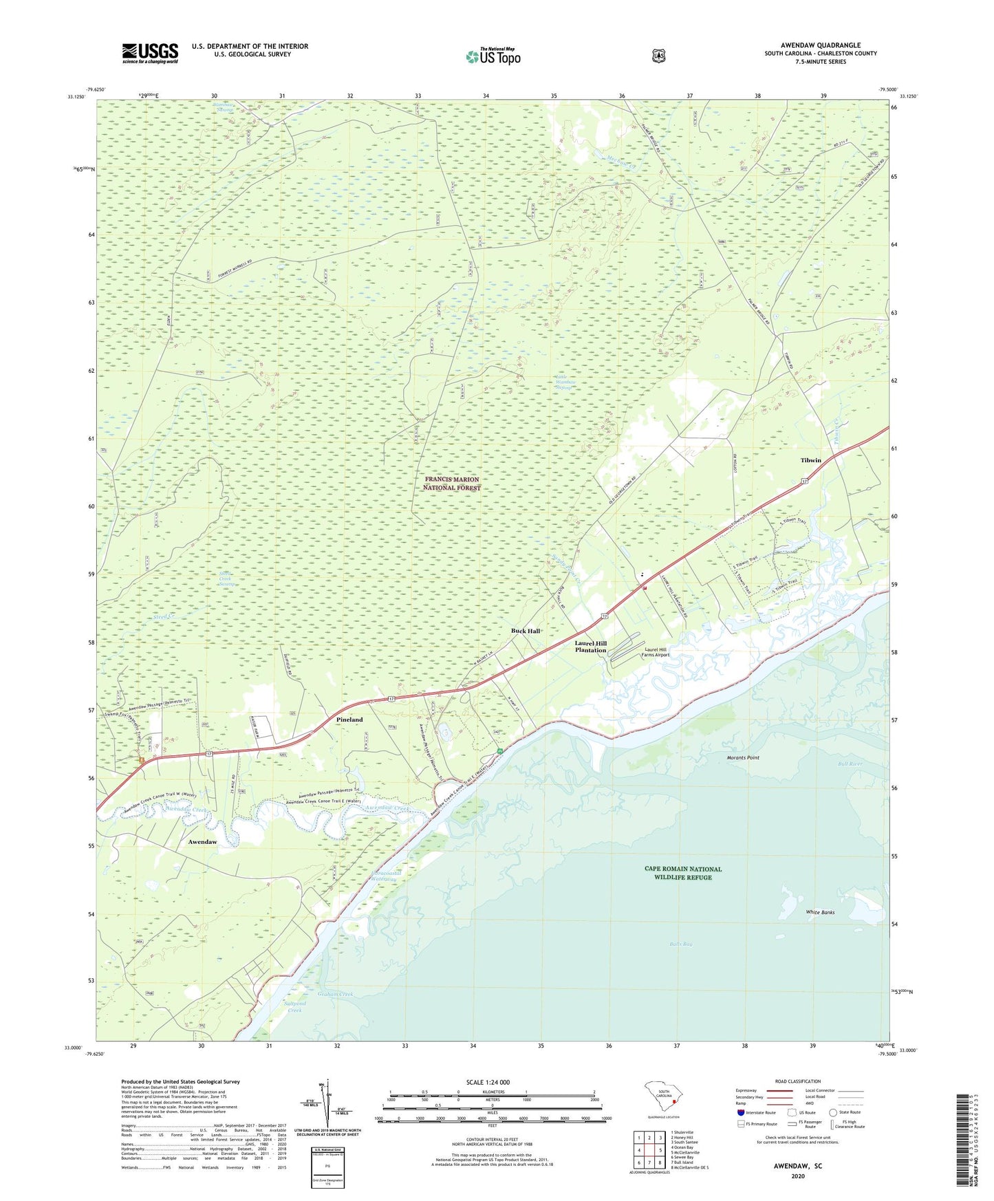
Awendaw South Carolina US Topo Map
Couldn't load pickup availability
Also explore the Awendaw Forest Service Topo of this same quad for updated USFS data
2024 topographic map quadrangle Awendaw in the state of South Carolina. Scale: 1:24000. Based on the newly updated USGS 7.5' US Topo map series, this map is in the following counties: Charleston. The map contains contour data, water features, and other items you are used to seeing on USGS maps, but also has updated roads and other features. This is the next generation of topographic maps. Printed on high-quality waterproof paper with UV fade-resistant inks.
Quads adjacent to this one:
West: Ocean Bay
Northwest: Shulerville
North: Honey Hill
Northeast: South Santee
East: McClellanville
Southeast: McClellanville OE S
South: Bull Island
Southwest: Sewee Bay
This map covers the same area as the classic USGS quad with code o33079a5.
Contains the following named places: Awendaw, Awendaw Chapel, Awendaw Creek, Awendaw Fire District Station 3, Buck Hall, Buck Hall Recreation Area, Buck Hall School, Cape Romain National Wildlife Refuge, Doe Hall Creek, Graham Creek, Harbor River, Laurel Hill Farms Airport, Laurel Hill Plantation, Little Wambaw Swamp, Little Wambaw Swamp Wilderness, Long Creek, McClellanville Division, Morants Point, Our Chapel, Pineland, Saint James Church, Saint James Santee Elementary School, Saint James School, Sandy Point Creek, Steed Creek Swamp, Tibwin, Tibwin Church, Tibwin Creek, Tibwin Plantation, Walnut Grove Ranger Station, White Banks