MyTopo
Bull Island South Carolina US Topo Map
Couldn't load pickup availability
Also explore the Bull Island Forest Service Topo of this same quad for updated USFS data
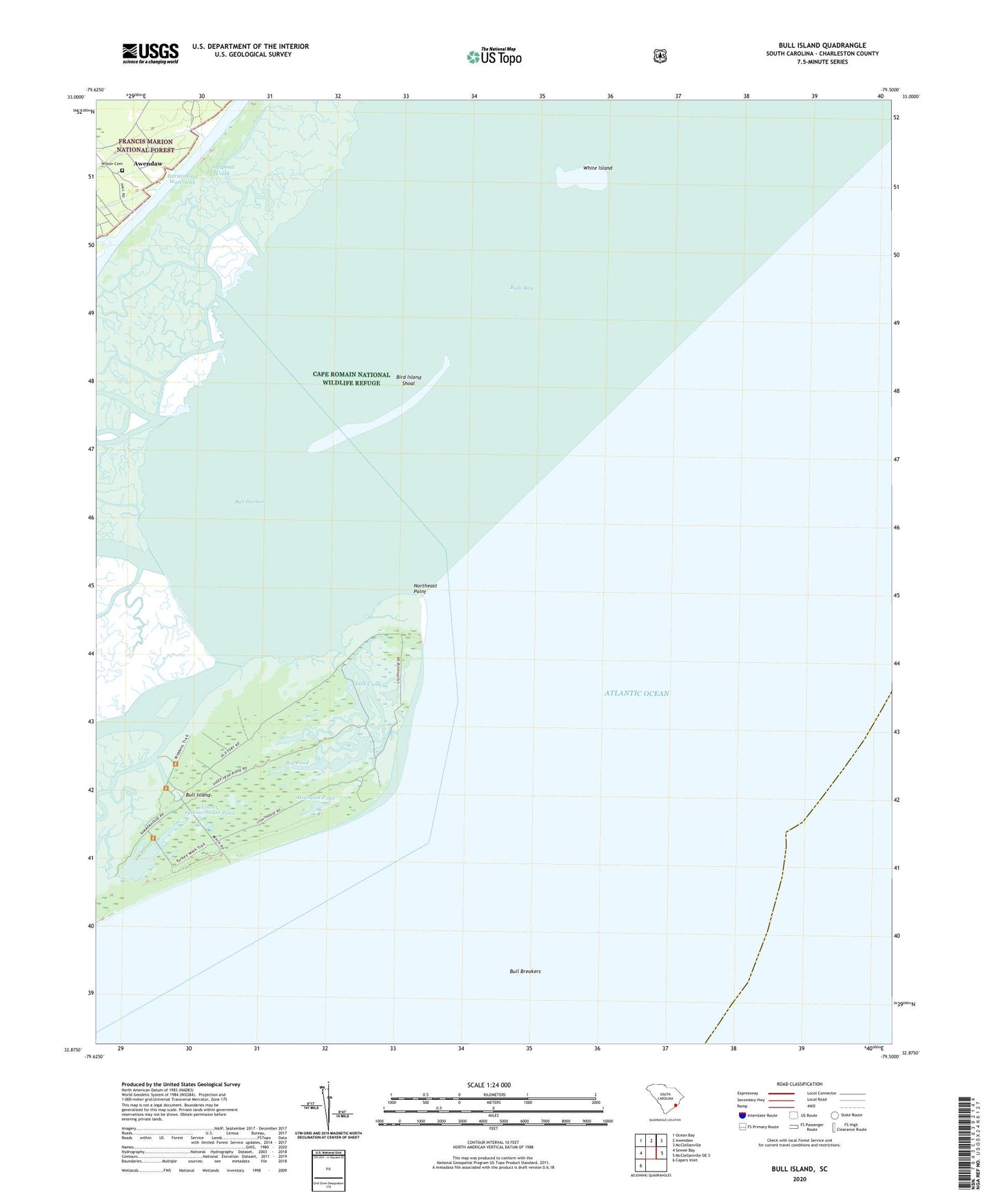
2024 topographic map quadrangle Bull Island in the state of South Carolina. Scale: 1:24000. Based on the newly updated USGS 7.5' US Topo map series, this map is in the following counties: Charleston. The map contains contour data, water features, and other items you are used to seeing on USGS maps, but also has updated roads and other features. This is the next generation of topographic maps. Printed on high-quality waterproof paper with UV fade-resistant inks.
Quads adjacent to this one:
West: Sewee Bay
Northwest: Ocean Bay
North: Awendaw
Northeast: McClellanville
East: McClellanville OE S
Southwest: Capers Inlet
This map covers the same area as the classic USGS quad with code o32079h5.
Contains the following named places: Anderson Creek, Belvedere Creek, Big Pond, Bird Island, Bird Island Shoal, Blind Creek, Bull Breakers, Bull Creek, Bull Harbor, Bull Island, Bulls Bay, Jack Creek, Lower Summerhouse Pond, Moccasin Pond, Northeast Point, Saltpond Creek, Sewee Camp, Summerhouse Creek, Turkey Walk Trail, Upper Summerhouse Pond, Vanderhorst Creek, Venning Creek, White Island, Wilson Cemetery