MyTopo
Tearcoat Branch South Carolina US Topo Map
Couldn't load pickup availability
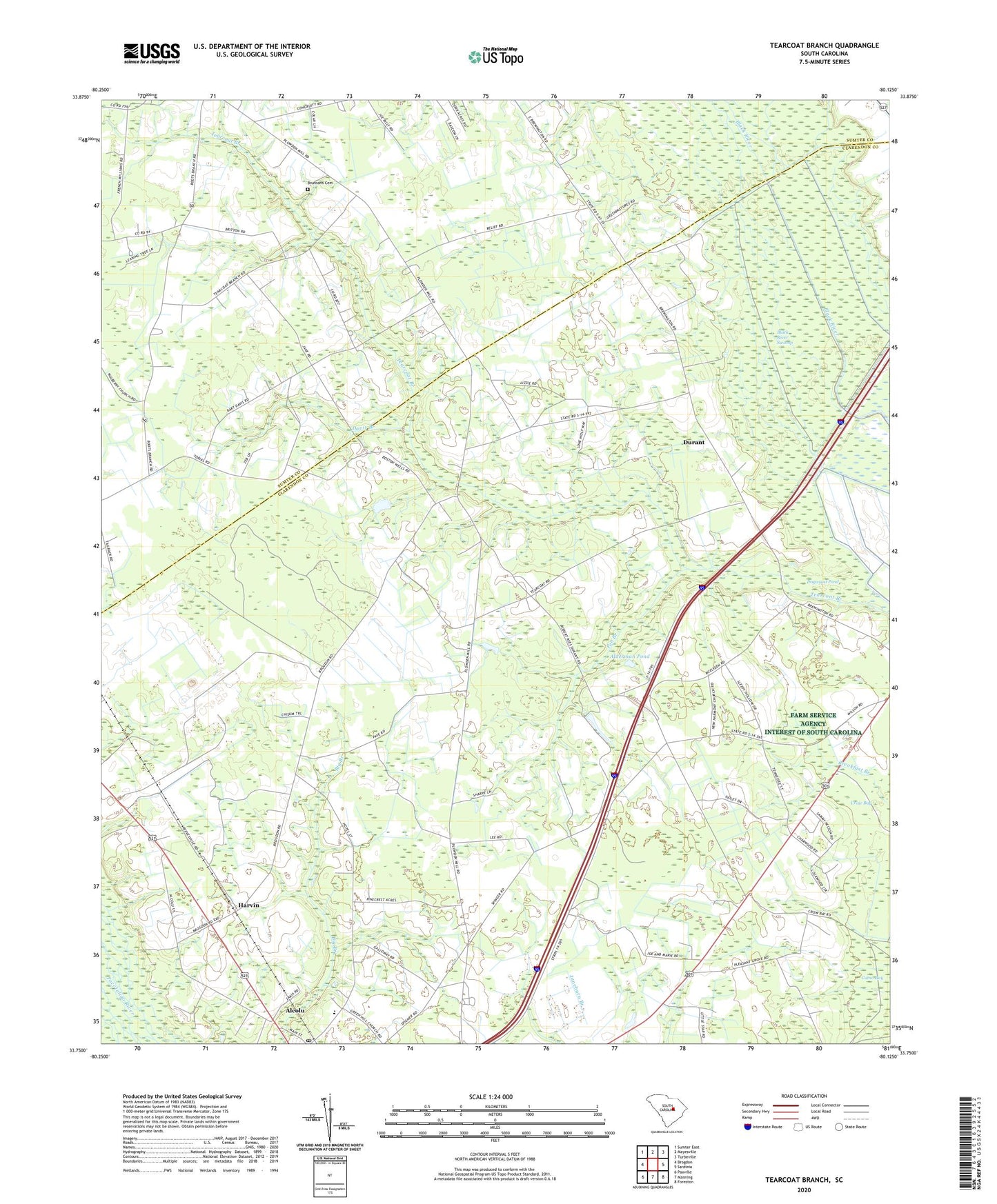
2020 topographic map quadrangle Tearcoat Branch in the state of South Carolina. Scale: 1:24000. Based on the newly updated USGS 7.5' US Topo map series, this map is in the following counties: Clarendon, Sumter. The map contains contour data, water features, and other items you are used to seeing on USGS maps, but also has updated roads and other features. This is the next generation of topographic maps. Printed on high-quality waterproof paper with UV fade-resistant inks.
Quads adjacent to this one:
West: Brogdon
Northwest: Sumter East
North: Mayesville
Northeast: Turbeville
East: Sardinia
Southeast: Foreston
South: Manning
Southwest: Paxville
Contains the following named places: Alcolu, Alcolu Census Designated Place, Alcolu Division, Alcolu Elementary School, Alcolu Post Office, Alderman Pond, Alderman Pond Dam D-3486, Black River Swamp, Brunsons Cemetery, Congruity Church, Congruity School, Crow Bay, Cuttinumber Pond, Cuttinumber Pond Dam D-3482, Davis Branch, Durant, Enterprise School, Green Hill Church, Harmony Church, Harvin, Harvin School, Mount Milian Church, Mount Nebo Church, Mount Nero School, Mount Olive School, New Harmony Church, Oak Grove Church, Pen Branch, Pleasant Grove Church, Pleasant Grove School, Reevesville Church, Reevesville School, Sumter Southeast Division, Tearcoat Branch, Westminister Church, Westminister School, ZIP Codes: 29001, 29051