MyTopo
Mayesville South Carolina US Topo Map
Couldn't load pickup availability
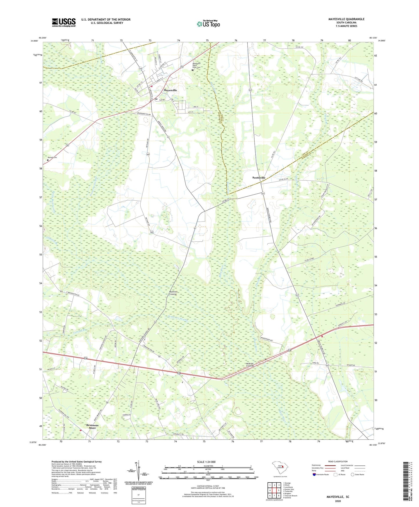
2024 topographic map quadrangle Mayesville in the state of South Carolina. Scale: 1:24000. Based on the newly updated USGS 7.5' US Topo map series, this map is in the following counties: Sumter, Lee. The map contains contour data, water features, and other items you are used to seeing on USGS maps, but also has updated roads and other features. This is the next generation of topographic maps. Printed on high-quality waterproof paper with UV fade-resistant inks.
Quads adjacent to this one:
West: Sumter East
Northwest: Oswego
North: Elliott
Northeast: Lynchburg
East: Turbeville
Southeast: Sardinia
South: Tearcoat Branch
Southwest: Brogdon
This map covers the same area as the classic USGS quad with code o33080h2.
Contains the following named places: Alligator Branch, Beulah Cemetery, Beulah Church, Beulah School, Black River Lookout Tower, Brunsons Store, Church Branch, Coldstream Plantation, Concord Branch, Concord Church, Dabbs Airport, Eastern School, Friersons Store, Goodwill Chapel, Goodwill Church, Goodwill School, Howard Chapel, Howard School, Lewis Chapel, Lewis School, Little Long Branch, Long Branch, Mayesville, Mayesville Black River Cemetery, Mayesville Elementary School, Mayesville Post Office, Mayewood School, McBride Corners, McBride Crossing, Muldrows Crossing, Rocky Bluff Swamp, Saint James Church, Saint Peter Church, Saint Peter School, Salem Black River Church, Scape Ore Swamp, Scottsville, Scottville School, Sumter Fire Department Concord Station 10, Sumter Fire Department Dabbs Station 19, Sumter Fire Department Mayesville Station 5, Town of Mayesville, Wilsons Store, Witherspoon School