MyTopo
Foreston South Carolina US Topo Map
Couldn't load pickup availability
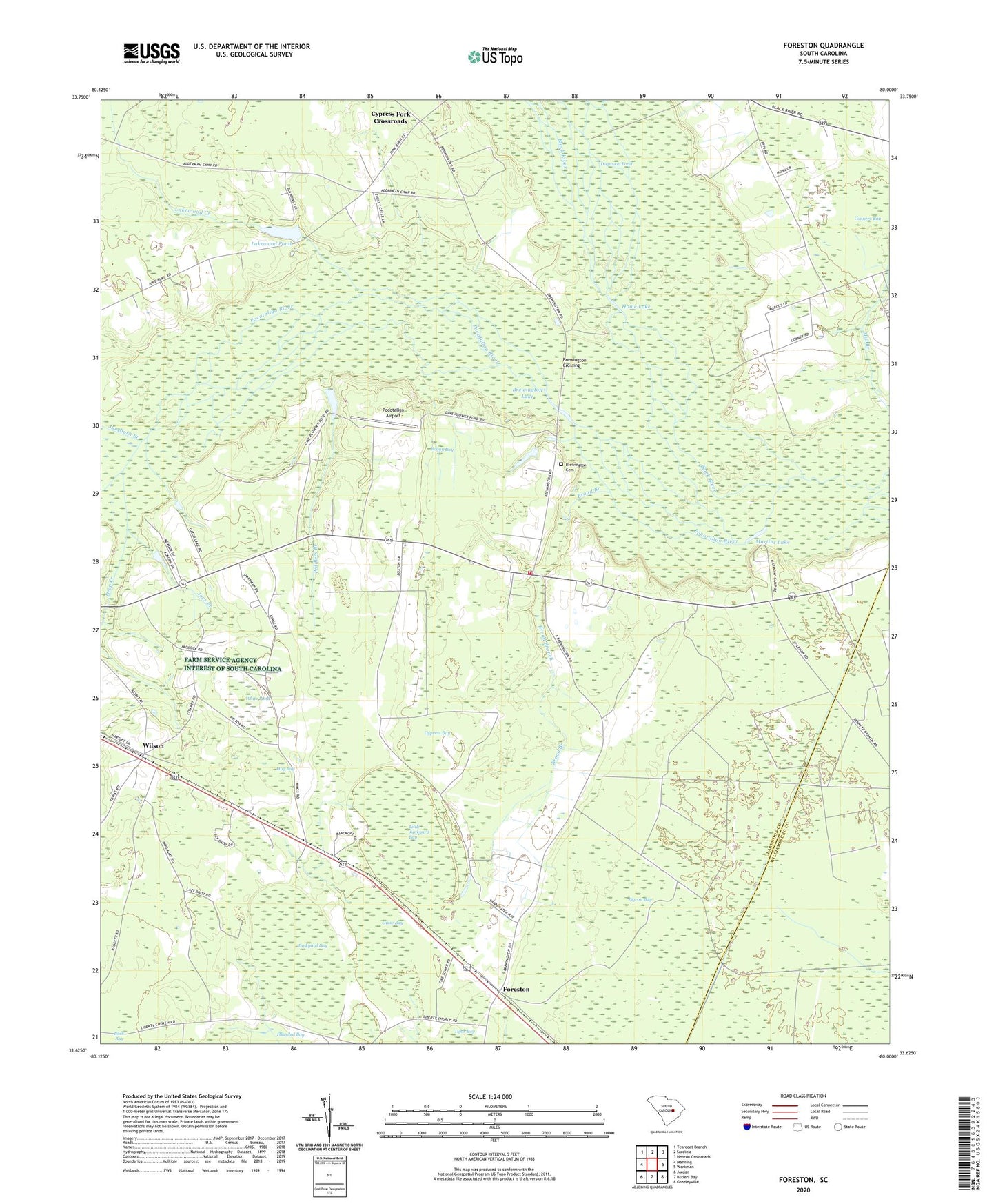
2024 topographic map quadrangle Foreston in the state of South Carolina. Scale: 1:24000. Based on the newly updated USGS 7.5' US Topo map series, this map is in the following counties: Clarendon, Williamsburg. The map contains contour data, water features, and other items you are used to seeing on USGS maps, but also has updated roads and other features. This is the next generation of topographic maps. Printed on high-quality waterproof paper with UV fade-resistant inks.
Quads adjacent to this one:
West: Manning
Northwest: Tearcoat Branch
North: Sardinia
Northeast: Hebron Crossroads
East: Workman
Southeast: Greeleyville
South: Butlers Bay
Southwest: Jordan
This map covers the same area as the classic USGS quad with code o33080f1.
Contains the following named places: Biggers Church, Boggy Bay, Brewington, Brewington Cemetery, Brewington Church, Brewington Crossing, Brewington Lake, Briggs Church, Briggs School, Broad Branch, Brunson Branch, Camp Harmony, Clarendon County Fire Department Station 11, Conyers Bay, Cypress Bay, Cypress Folk School, Cypress Fork Church, Cypress Fork Crossroads, Deep Creek, Dogwood Pond, Foreston, Foreston Census Designated Place, Foreston Church, Foreston Lookout Tower, Foreston School, Guise Bay, Hardy Pond, Hog Bay, Holliday School, Holy Rock Church, Home Lake, Joes Branch, Jordan Pond, Juneburn Branch, Junkyard Bay, Kings Chapel, Knights Hill Church, Lakewood, Lakewood Creek, Lakewood Pond, Little Junkyard Bay, Live Oak Church, Manning East Division, Martins Lake, Mill Branch, Peddlers Branch, Pigeon Bay, Plowden Pond Dam D-3493, Pocotaligo Airport, Pocotaligo River, Saint Michael School, Saint Michaels Church, South Carolina Noname 14015 D-3490 Dam, South Carolina Noname 14017 D-3494 Dam, White Pond, Wilson, Wilson Grove Church, Wilson Mill School, Wilson School, Wilson Union Church, Wilson Union School