MyTopo
Turbeville South Carolina US Topo Map
Couldn't load pickup availability
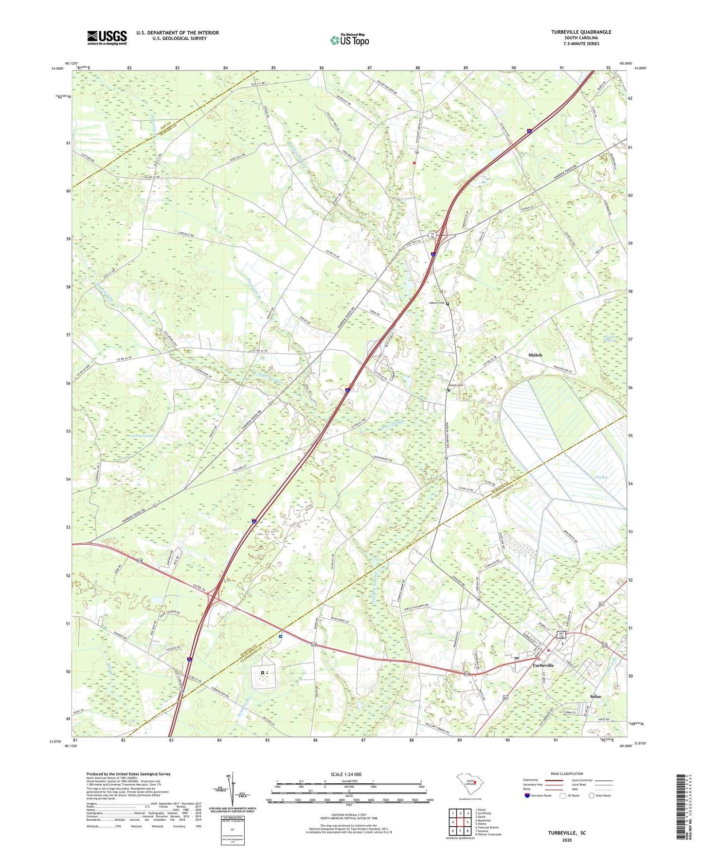
2020 topographic map quadrangle Turbeville in the state of South Carolina. Scale: 1:24000. Based on the newly updated USGS 7.5' US Topo map series, this map is in the following counties: Sumter, Clarendon, Lee. The map contains contour data, water features, and other items you are used to seeing on USGS maps, but also has updated roads and other features. This is the next generation of topographic maps. Printed on high-quality waterproof paper with UV fade-resistant inks.
Quads adjacent to this one:
West: Mayesville
Northwest: Elliott
North: Lynchburg
Northeast: Sardis
East: Olanta
Southeast: Hebron Crossroads
South: Sardinia
Southwest: Tearcoat Branch
Contains the following named places: Asbury Cemetery, Asbury Church, Asbury School, Beulah Church, Clarendon Fire Department Station 2, Cowbay Swamp, Dennis Memorial Auditorium, Dial Bay, East Clarendon High School, East Clarendon School, Faith Bible Church, Free Will Baptist Childrens Home, Friendship Church, Hickory Grove Church, Hickory Grove School, Holiness Church, Hope Swamp, Hudgens Academy, Johnson School, Mount Sinai Church, Mount Sinai School, Muldrow School, Oak Grove Church, Pineland Plantation Golf Club, Pleasant Grove, Pleasant Grove Church, Pleasant Grove School, Plum Hill School, Plumhaw School, Rose Hill Church, Rose Hill School, Seloc, Shiloh, Shiloh Cemetery, Shiloh Census Designated Place, Shiloh Church, Shiloh Division, South Carolina Noname 14006 D-3481 Dam, Sumter Fire Department Pleasant Grove Station 4, Sunnyside School, Threemile Branch, Town of Turbeville, Trinity Church, Trinity Cross Roads, Turbeville, Turbeville Correctional Institution, Turbeville Correctional Institution Infirmary, Turbeville Police Department, Turbeville Post Office, Turbeville Town Hall, ZIP Code: 29162