MyTopo
Warsaw South Carolina US Topo Map
Couldn't load pickup availability
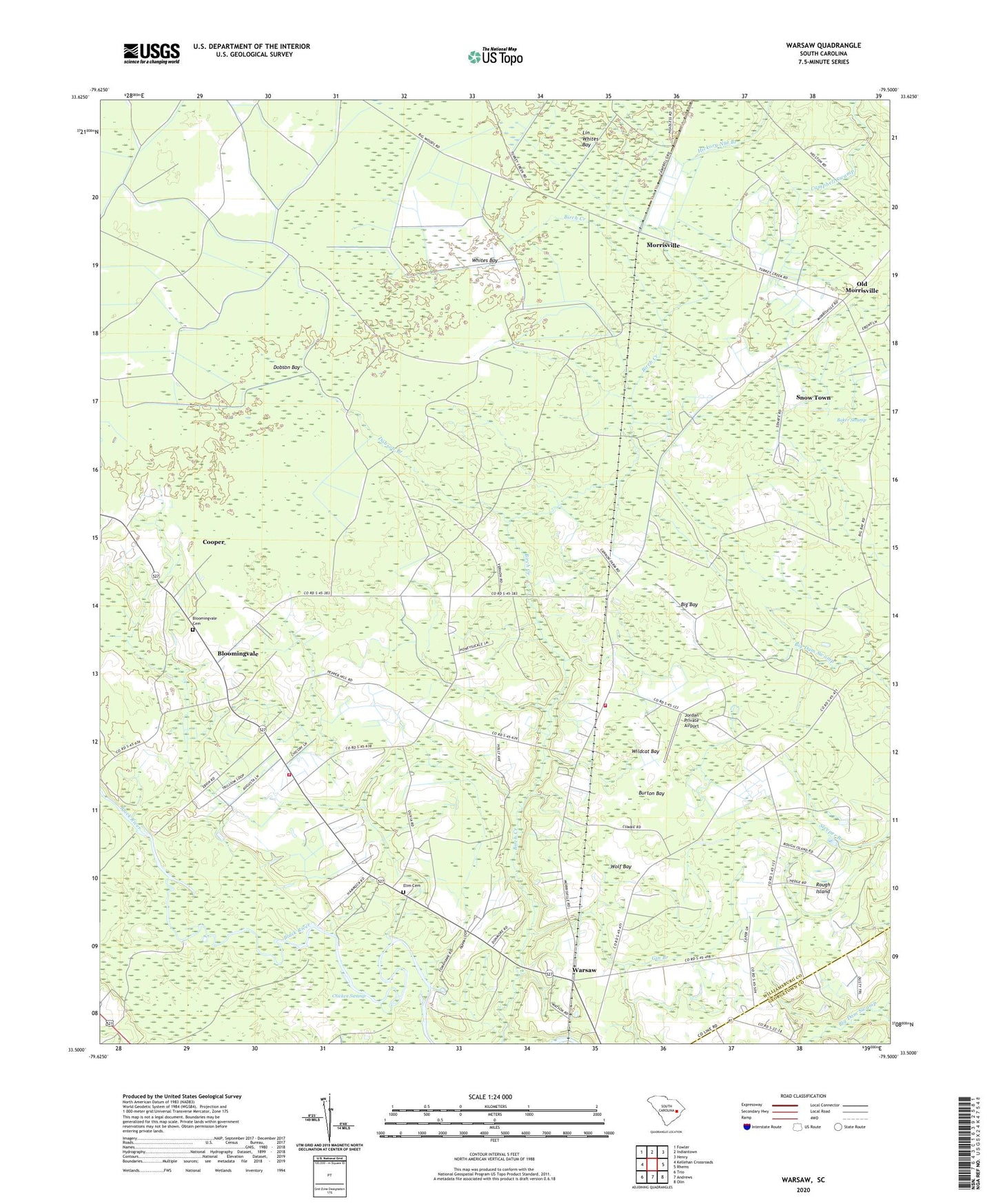
2024 topographic map quadrangle Warsaw in the state of South Carolina. Scale: 1:24000. Based on the newly updated USGS 7.5' US Topo map series, this map is in the following counties: Williamsburg, Georgetown. The map contains contour data, water features, and other items you are used to seeing on USGS maps, but also has updated roads and other features. This is the next generation of topographic maps. Printed on high-quality waterproof paper with UV fade-resistant inks.
Quads adjacent to this one:
West: Kellehan Crossroads
Northwest: Fowler
North: Indiantown
Northeast: Henry
East: Rhems
Southeast: Olin
South: Andrews
Southwest: Trio
This map covers the same area as the classic USGS quad with code o33079e5.
Contains the following named places: Asbury Church, Baker Swamp, Big Bay, Birch Creek Church, Birch Creek School, Black River Church, Bloomingvale, Bloomingvale Baptist Church, Bloomingvale Cemetery, Bloomingvale School, Burton Bay, Cooper, Dobson Bay, Dobson Branch, Elim Cemetery, Elim United Methodist Church, Jordan Private Airport, Lin Whites Bay, Little Star Church, Morrisville, Mount Zion Church, Mount Zion School, Nesmith Division, Old Morrisville, Piney Forest Church, Piney Forest School, Rough Island, Snow Hill Church, Snow Town, Warsaw, Warsaw School, Whites Bay, Wildcat Bay, Williamsburg County Fire Department Station 12, Williamsburg County Fire Department Station 16, Wolf Bay