MyTopo
Alleman Station South Dakota US Topo Map
Couldn't load pickup availability
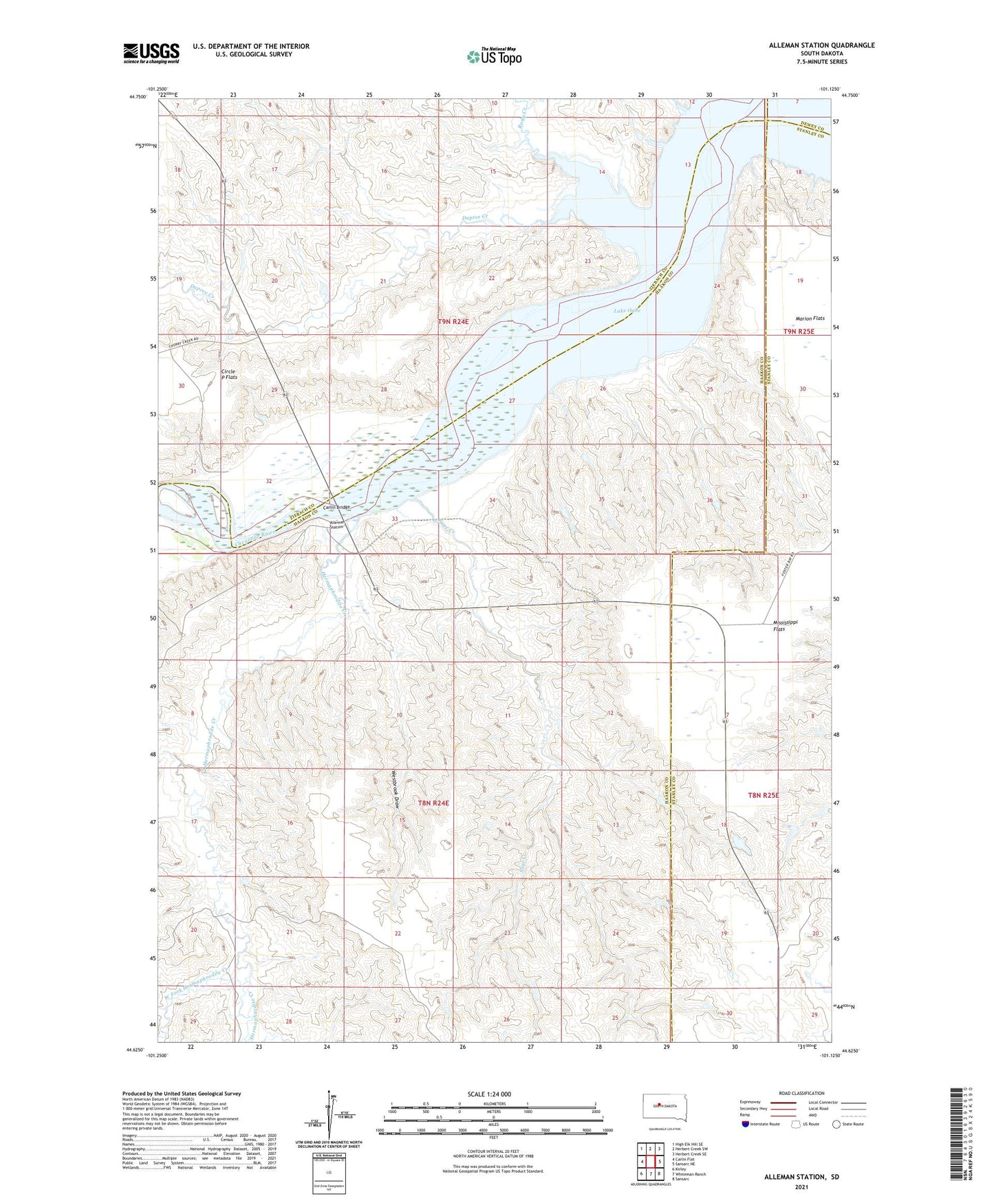
2021 topographic map quadrangle Alleman Station in the state of South Dakota. Scale: 1:24000. Based on the newly updated USGS 7.5' US Topo map series, this map is in the following counties: Haakon, Ziebach, Stanley, Dewey. The map contains contour data, water features, and other items you are used to seeing on USGS maps, but also has updated roads and other features. This is the next generation of topographic maps. Printed on high-quality waterproof paper with UV fade-resistant inks.
Quads adjacent to this one:
West: Carlin Flat
Northwest: High Elk Hill SE
North: Herbert Creek SW
Northeast: Herbert Creek SE
East: Sansarc NE
Southeast: Sansarc
South: Whiteman Ranch
Southwest: Kirley
Contains the following named places: Alleman Station, Carlin Bridge, Carr Ranch, Carr School, Circle P Flats, Dupree Church, Dupree Creek, Hermaphrodite Creek, Jordan Ranch, Mississippi Flats, Pearman Ranch, Rudy Creek, Sage Creek, Scarborough Airstrip, West Fork Hermaphrodite Creek, Westbrook Draw