MyTopo
Carlin Flat South Dakota US Topo Map
Couldn't load pickup availability
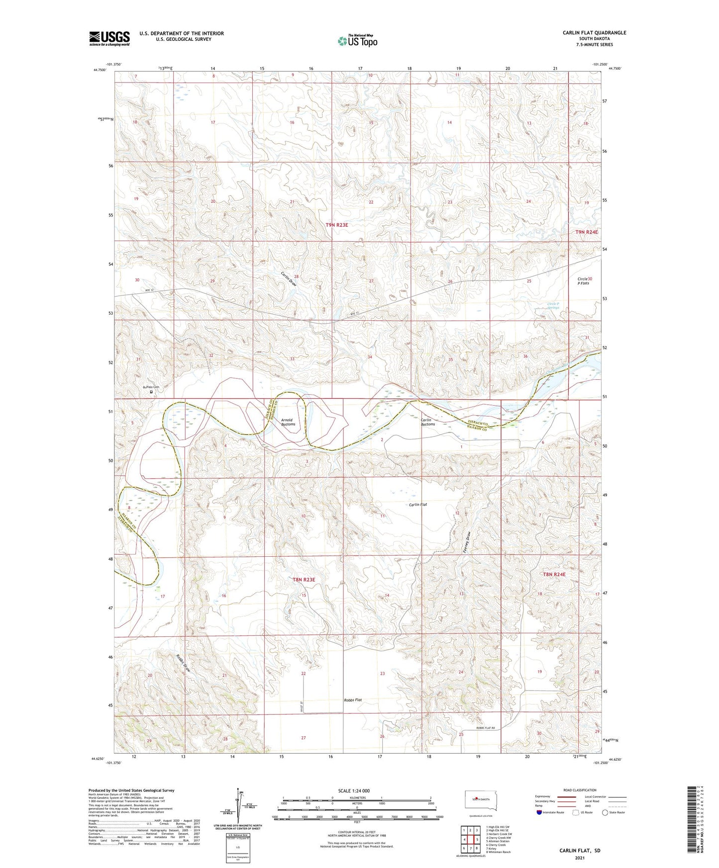
2021 topographic map quadrangle Carlin Flat in the state of South Dakota. Scale: 1:24000. Based on the newly updated USGS 7.5' US Topo map series, this map is in the following counties: Haakon, Ziebach. The map contains contour data, water features, and other items you are used to seeing on USGS maps, but also has updated roads and other features. This is the next generation of topographic maps. Printed on high-quality waterproof paper with UV fade-resistant inks.
Quads adjacent to this one:
West: Cherry Creek NW
Northwest: High Elk Hill SW
North: High Elk Hill SE
Northeast: Herbert Creek SW
East: Alleman Station
Southeast: Whiteman Ranch
South: Kirley
Southwest: Cherry Creek
This map covers the same area as the classic USGS quad with code o44101f3.
Contains the following named places: Annis Ranch, Arnold Bottoms, Buffalo Cemetery, Carlin, Carlin Bottoms, Carlin Draw, Carlin Flat, Carlin School, Carlin-Garrett Ranch, Circle P Springs, Feeney Draw, Hamilton Airstrip, K Briggs Ranch, L Garrett Ranch, Robbs Draw, W Briggs Ranch