MyTopo
Amherst South Dakota US Topo Map
Couldn't load pickup availability
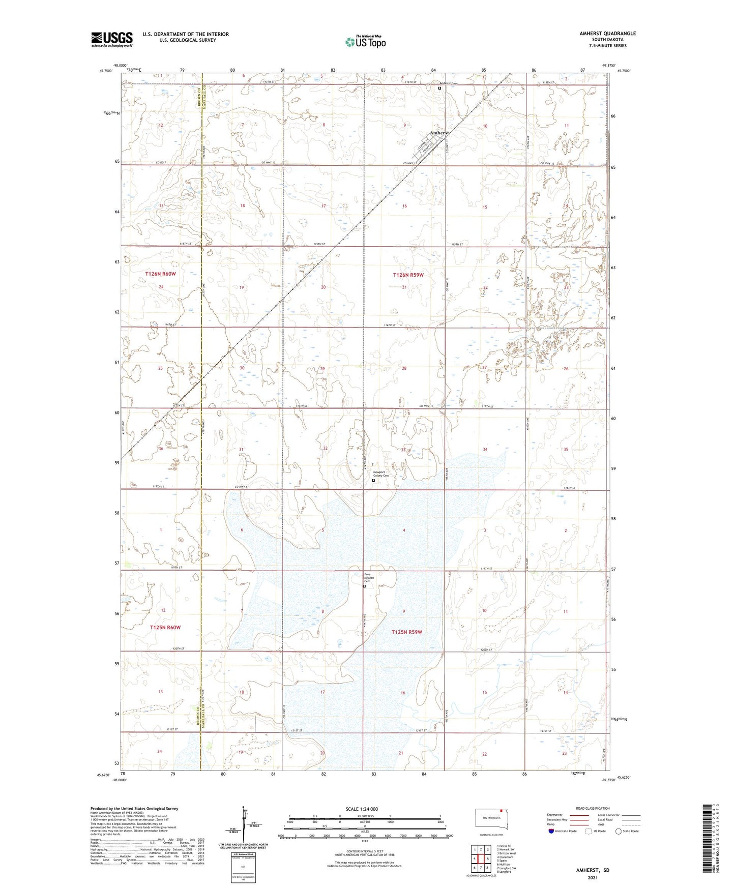
2021 topographic map quadrangle Amherst in the state of South Dakota. Scale: 1:24000. Based on the newly updated USGS 7.5' US Topo map series, this map is in the following counties: Marshall, Brown. The map contains contour data, water features, and other items you are used to seeing on USGS maps, but also has updated roads and other features. This is the next generation of topographic maps. Printed on high-quality waterproof paper with UV fade-resistant inks.
Quads adjacent to this one:
West: Claremont
Northwest: Hecla SE
North: Newark SW
Northeast: Britton West
East: Spain
Southeast: Langford
South: Langford SW
Southwest: Huffton
This map covers the same area as the classic USGS quad with code o45097f8.
Contains the following named places: Amherst, Amherst Cemetery, Amherst Post Office, Docter Feedlot, Free Mission Cemetery, Frisby, Newport Colony, Newport Colony Cemetery, Newport Colony Census Designated Place, Newport Colony Elementary School, School Number 3, School Number 4, School Number 5, Township of Newport, Township of Norwich, Township of Weston