MyTopo
Antelope Valley South Dakota US Topo Map
Couldn't load pickup availability
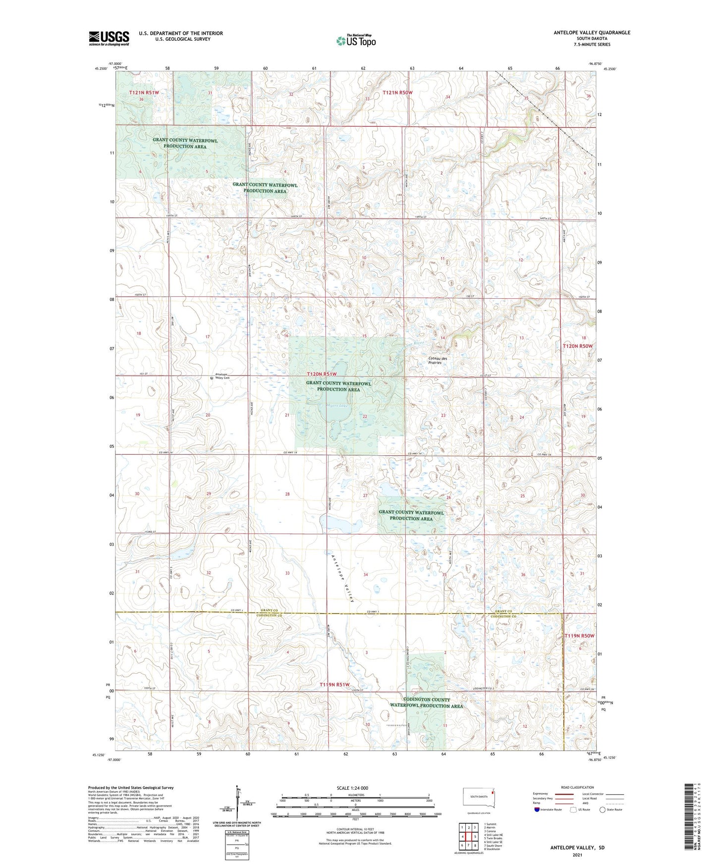
2021 topographic map quadrangle Antelope Valley in the state of South Dakota. Scale: 1:24000. Based on the newly updated USGS 7.5' US Topo map series, this map is in the following counties: Grant, Codington. The map contains contour data, water features, and other items you are used to seeing on USGS maps, but also has updated roads and other features. This is the next generation of topographic maps. Printed on high-quality waterproof paper with UV fade-resistant inks.
Quads adjacent to this one:
West: Still Lake NE
Northwest: Summit
North: Marvin
Northeast: Corona
East: Twin Brooks
Southeast: Stockholm
South: South Shore
Southwest: Still Lake SE
Contains the following named places: Antelope Valley, Antelope Valley Cemetery, Blue Cloud Abbey Dam Number 1, Blue Cloud Abbey Dam Number 2, Grant County Waterfowl Production Area, Mazeppa State Public Shooting Area, Myers Lake, Township of Mazeppa, ZIP Code: 57263