MyTopo
Stockholm South Dakota US Topo Map
Couldn't load pickup availability
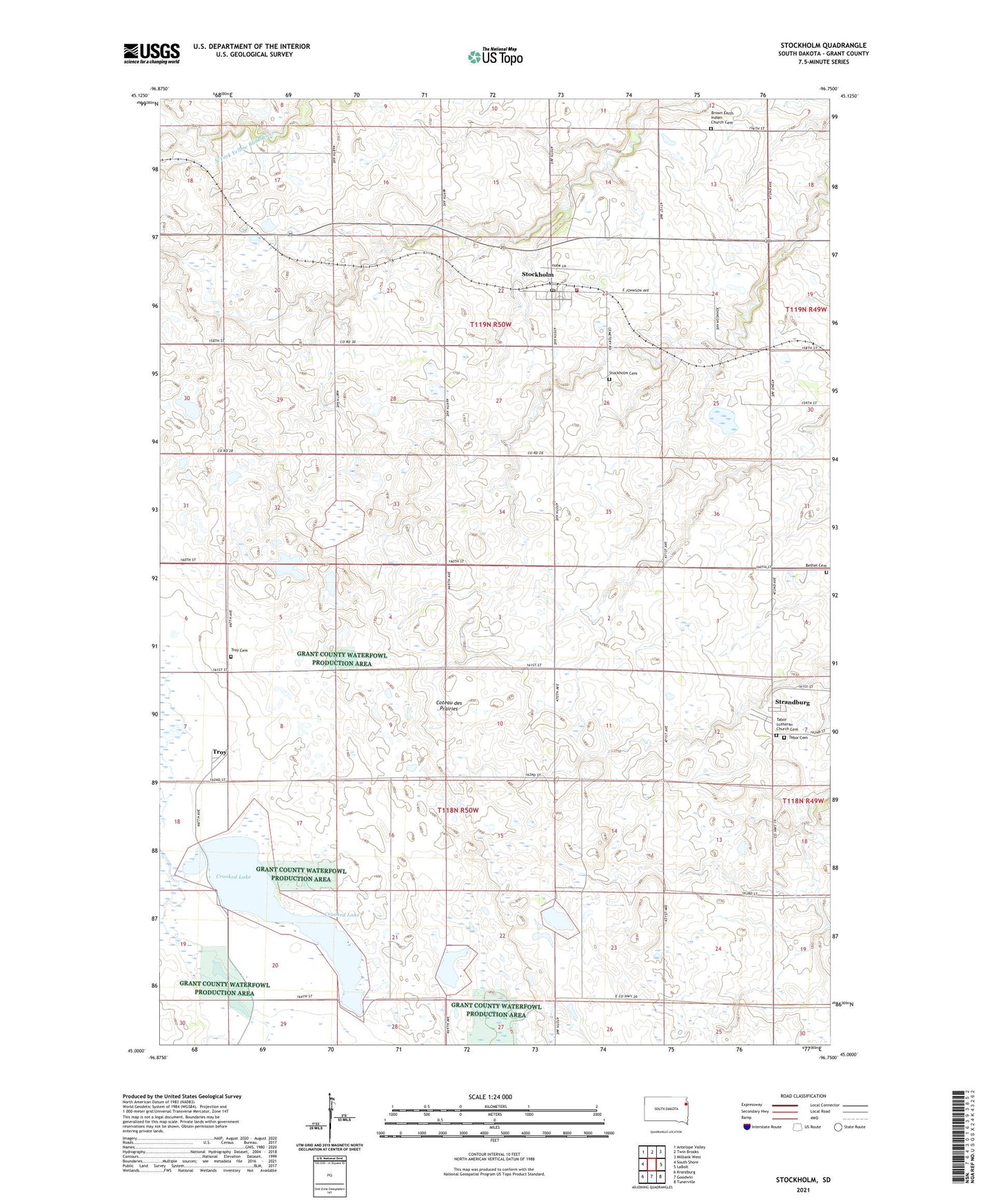
2021 topographic map quadrangle Stockholm in the state of South Dakota. Scale: 1:24000. Based on the newly updated USGS 7.5' US Topo map series, this map is in the following counties: Grant. The map contains contour data, water features, and other items you are used to seeing on USGS maps, but also has updated roads and other features. This is the next generation of topographic maps. Printed on high-quality waterproof paper with UV fade-resistant inks.
Quads adjacent to this one:
West: South Shore
Northwest: Antelope Valley
North: Twin Brooks
Northeast: Milbank West
East: LaBolt
Southeast: Tunerville
South: Goodwin
Southwest: Kranzburg
This map covers the same area as the classic USGS quad with code o45096a7.
Contains the following named places: Bethel Cemetery, Brown Earth Church, Brown Earth Indian Church Cemetery, Crooked Lake, Grant County Mini-Library III, Pyror Slough, Stockholm, Stockholm Cemetery, Stockholm Fire Department, Stockholm Post Office, Strandburg, Strandburg Post Office, Tabor Cemetery, Tabor Lutheran Church, Tabor Lutheran Church Cemetery, Town of Stockholm, Town of Strandburg, Township of Stockholm, Township of Troy, Troy, Troy Cemetery, Troy Lake State Public Shooting Area, Troy Post Office, ZIP Code: 57264