MyTopo
Still Lake NE South Dakota US Topo Map
Couldn't load pickup availability
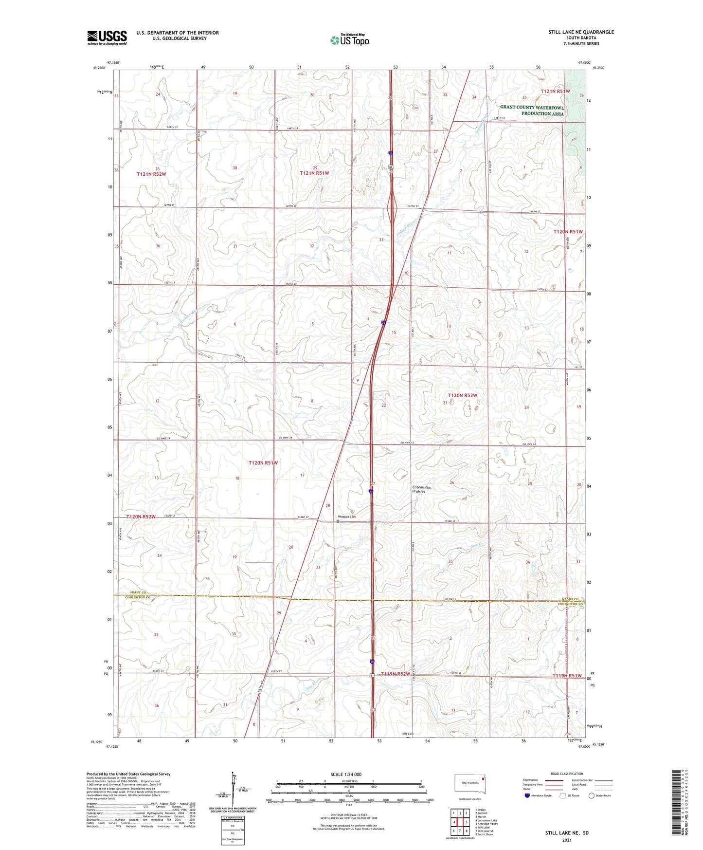
2021 topographic map quadrangle Still Lake NE in the state of South Dakota. Scale: 1:24000. Based on the newly updated USGS 7.5' US Topo map series, this map is in the following counties: Grant, Codington. The map contains contour data, water features, and other items you are used to seeing on USGS maps, but also has updated roads and other features. This is the next generation of topographic maps. Printed on high-quality waterproof paper with UV fade-resistant inks.
Quads adjacent to this one:
West: Lonesome Lake
Northwest: Ortley
North: Summit
Northeast: Marvin
East: Antelope Valley
Southeast: South Shore
South: Still Lake SE
Southwest: Still Lake
This map covers the same area as the classic USGS quad with code o45097b1.
Contains the following named places: Hyde School Number 69, Mazeppa Cemetery, Saint Johns Church, Strouseton