MyTopo
Arlington South Dakota US Topo Map
Couldn't load pickup availability
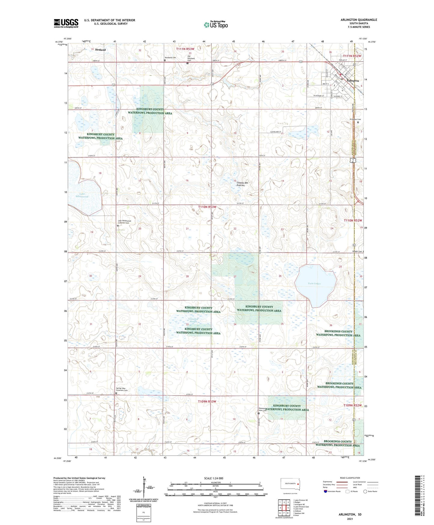
2021 topographic map quadrangle Arlington in the state of South Dakota. Scale: 1:24000. Based on the newly updated USGS 7.5' US Topo map series, this map is in the following counties: Kingsbury, Brookings. The map contains contour data, water features, and other items you are used to seeing on USGS maps, but also has updated roads and other features. This is the next generation of topographic maps. Printed on high-quality waterproof paper with UV fade-resistant inks.
Quads adjacent to this one:
West: Lake Preston East
Northwest: Lake Preston NE
North: Badger
Northeast: Arlington NE
East: Lake Sinai
Southeast: Sinai
South: Madison NW
Southwest: Oldham
This map covers the same area as the classic USGS quad with code o44097c2.
Contains the following named places: Arlington, Arlington Ambulance Service, Arlington Cemetery, Arlington City Hall, Arlington Community Library, Arlington Elementary School, Arlington Fire Department, Arlington High School, Arlington Junior High School, Arlington Police Department, Arlington Post Office, City of Arlington, KESD-FM (Brookings), Kingsbury County Waterfowl Production Area, Lake Whitewood Church, Lake Whitewood Lutheran Cemetery, Lutheran Church, Nordland Cemetery, Old Nordland Cemetery, Pleasant View Cemetery, School Number 1, School Number 2, School Number 40, School Number 41, School Number 42, School Number 8, Spring Lake Church, Spring Lake Covenant Cemetery, Tenneboe Slough, Township of Spring Lake, Twin Lakes