MyTopo
Arlington NE South Dakota US Topo Map
Couldn't load pickup availability
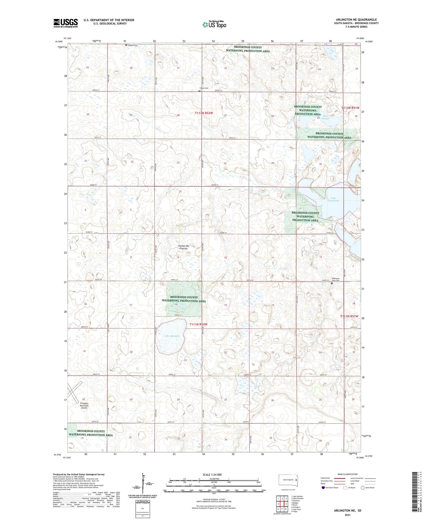
2021 topographic map quadrangle Arlington NE in the state of South Dakota. Scale: 1:24000. Based on the newly updated USGS 7.5' US Topo map series, this map is in the following counties: Brookings. The map contains contour data, water features, and other items you are used to seeing on USGS maps, but also has updated roads and other features. This is the next generation of topographic maps. Printed on high-quality waterproof paper with UV fade-resistant inks.
Quads adjacent to this one:
West: Badger
Northwest: Lake Norden
North: Lake Poinsett
Northeast: Estelline
East: Bruce
Southeast: Volga
South: Lake Sinai
Southwest: Arlington
Contains the following named places: Bethel Cemetery, Johnson Lake, Lake Mitchell, Moe Slough, Oakwood Lakes, Oakwood Zion Cemetery, Township of Laketon, Township of Winsor, Trasta Cemetery, Turtle Lake