MyTopo
Lake Norden South Dakota US Topo Map
Couldn't load pickup availability
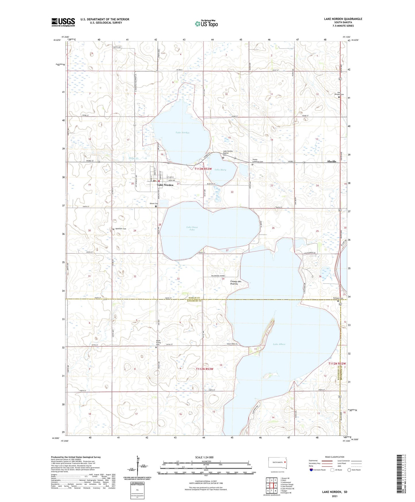
2021 topographic map quadrangle Lake Norden in the state of South Dakota. Scale: 1:24000. Based on the newly updated USGS 7.5' US Topo map series, this map is in the following counties: Hamlin, Kingsbury, Brookings. The map contains contour data, water features, and other items you are used to seeing on USGS maps, but also has updated roads and other features. This is the next generation of topographic maps. Printed on high-quality waterproof paper with UV fade-resistant inks.
Quads adjacent to this one:
West: Gertson Slough
Northwest: Bryant NE
North: Hayti
Northeast: Castlewood
East: Lake Poinsett
Southeast: Arlington NE
South: Badger
Southwest: Lake Preston NE
This map covers the same area as the classic USGS quad with code o44097e2.
Contains the following named places: Alsville, Apostolic Cemetery, City of Lake Norden, Danish Lutheran Church, Denmark Post Office, Dolph Creek, East Norden Cemetery, East Norden Church, Lake Albert, Lake Mary, Lake Norden, Lake Norden Ambulance Service, Lake Norden Baptist Cemetery, Lake Norden City Office, Lake Norden Community Center, Lake Norden Fire Department, Lake Norden Post Office, Lake Saint John, Nora, Olivet Cemetery, Poinsett, Poinsett Cemetery, School Number 16, South Trinity Cemetery, Township of Norden, Trinity Lutheran Cemetery, ZIP Codes: 57214, 57248