MyTopo
Aurora South Dakota US Topo Map
Couldn't load pickup availability
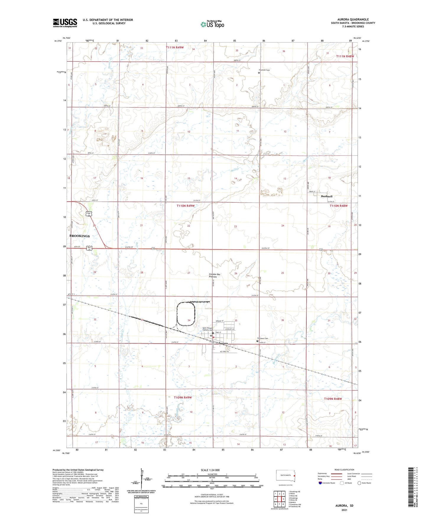
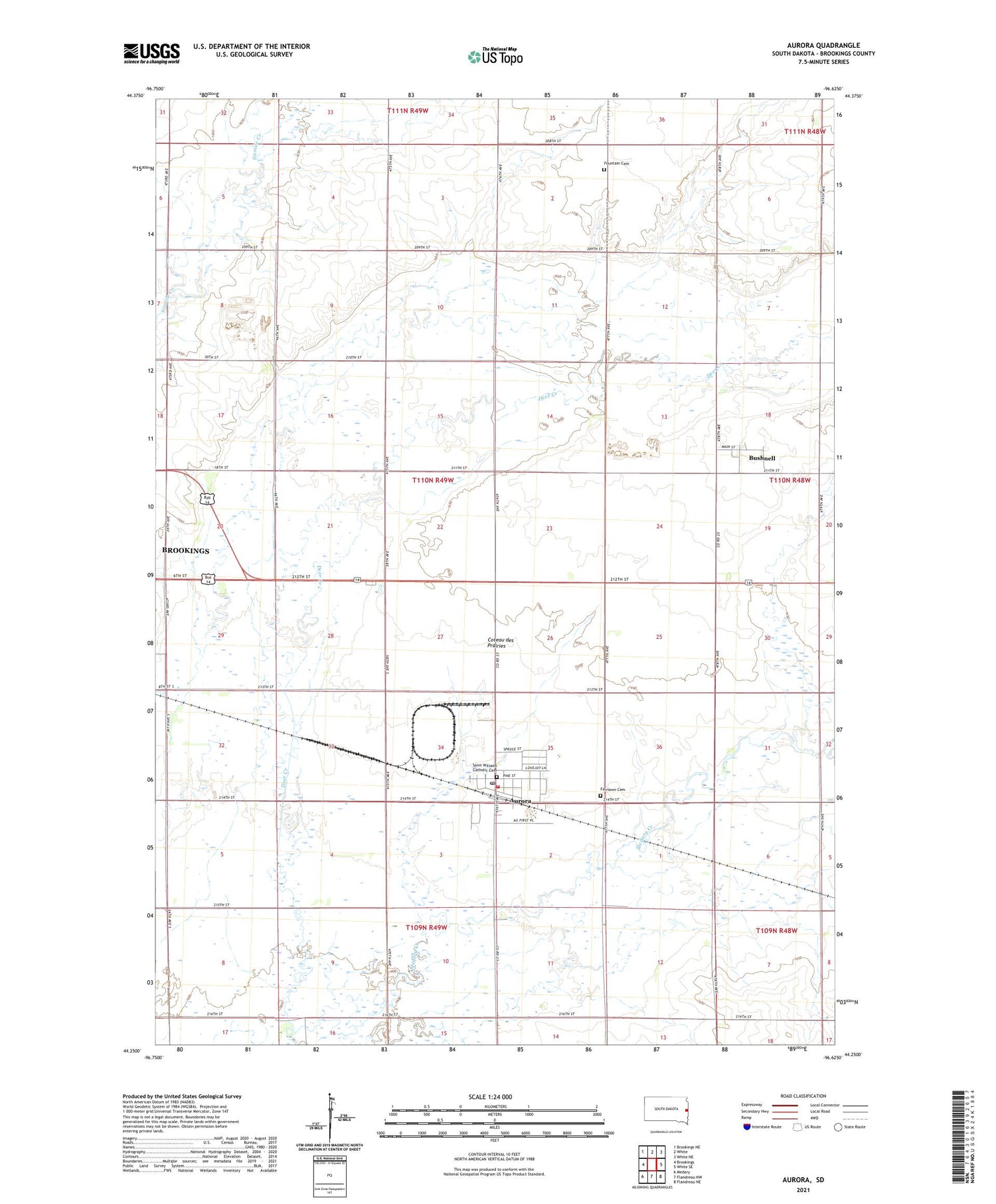
2021 topographic map quadrangle Aurora in the state of South Dakota. Scale: 1:24000. Based on the newly updated USGS 7.5' US Topo map series, this map is in the following counties: Brookings. The map contains contour data, water features, and other items you are used to seeing on USGS maps, but also has updated roads and other features. This is the next generation of topographic maps. Printed on high-quality waterproof paper with UV fade-resistant inks.
Quads adjacent to this one:
West: Brookings
Northwest: Brookings NE
North: White
Northeast: White NE
East: White SE
Southeast: Flandreau NE
South: Flandreau NW
Southwest: Medary
Contains the following named places: Aurora, Aurora Fire Department, Aurora Post Office, Aurora Prairie, Bushnell, Deer Creek, Fairlawn Cemetery, Fountain Cemetery, Fountain School, Saint Wiliams Catholic Cemetery, Town of Aurora, Town of Bushnell, Township of Aurora, ZIP Code: 57002