MyTopo
Brookings NE South Dakota US Topo Map
Couldn't load pickup availability
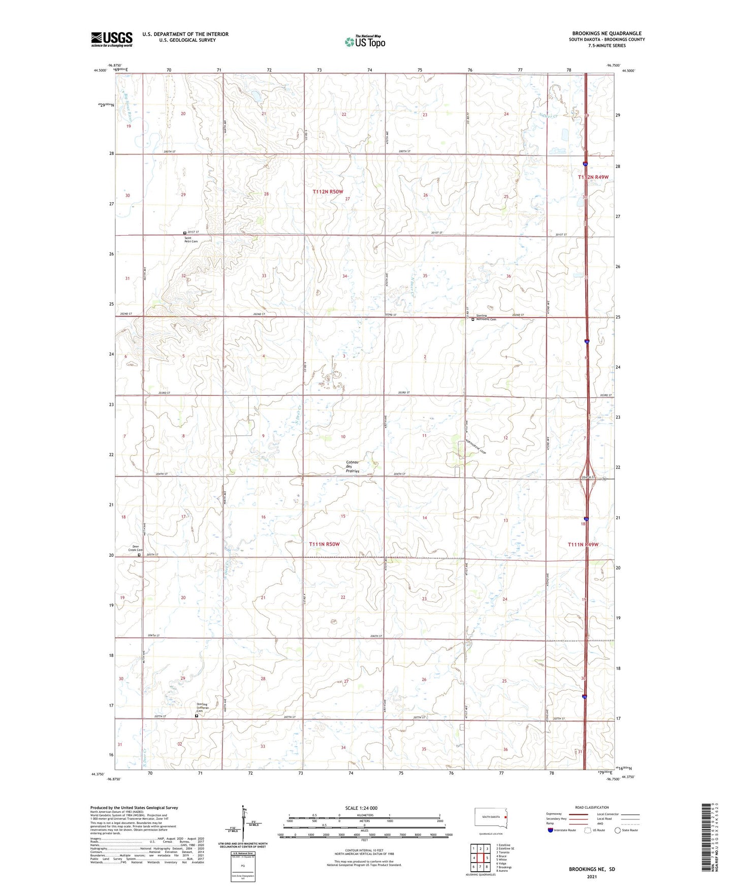
2021 topographic map quadrangle Brookings NE in the state of South Dakota. Scale: 1:24000. Based on the newly updated USGS 7.5' US Topo map series, this map is in the following counties: Brookings. The map contains contour data, water features, and other items you are used to seeing on USGS maps, but also has updated roads and other features. This is the next generation of topographic maps. Printed on high-quality waterproof paper with UV fade-resistant inks.
Quads adjacent to this one:
West: Bruce
Northwest: Estelline
North: Estelline SE
Northeast: Toronto
East: White
Southeast: Aurora
South: Brookings
Southwest: Volga
This map covers the same area as the classic USGS quad with code o44096d7.
Contains the following named places: Deer Creek Cemetery, North Grove Addition, Saint Petri Cemetery, Sterling Church, Sterling Lutheran Cemetery, Sterling Methodist Cemetery, Sterling Township Hall, Township of Sterling