
MyTopo
Badger South Dakota US Topo Map
Couldn't load pickup availability
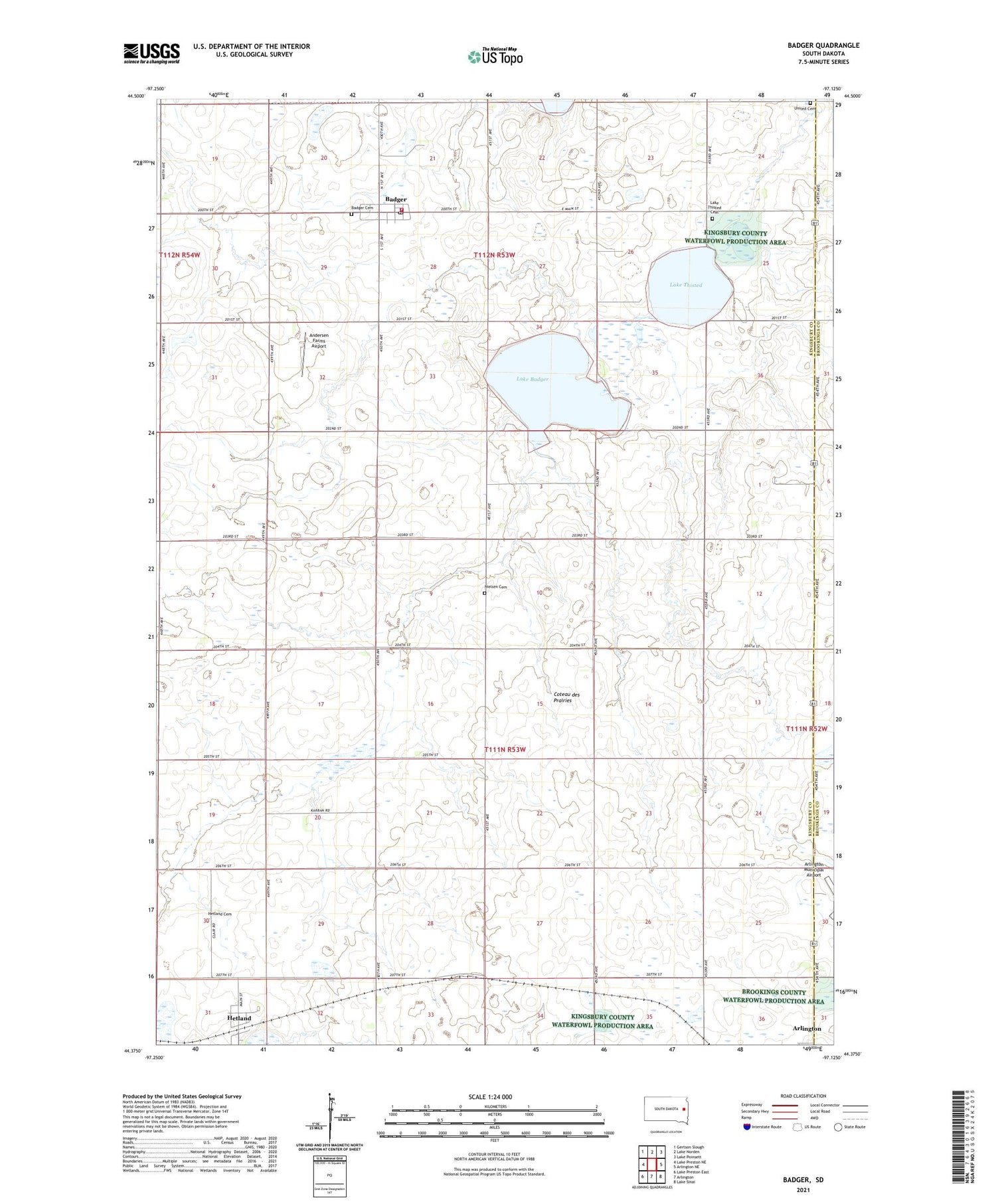
2021 topographic map quadrangle Badger in the state of South Dakota. Scale: 1:24000. Based on the newly updated USGS 7.5' US Topo map series, this map is in the following counties: Kingsbury, Brookings. The map contains contour data, water features, and other items you are used to seeing on USGS maps, but also has updated roads and other features. This is the next generation of topographic maps. Printed on high-quality waterproof paper with UV fade-resistant inks.
Quads adjacent to this one:
West: Lake Preston NE
Northwest: Gertson Slough
North: Lake Norden
Northeast: Lake Poinsett
East: Arlington NE
Southeast: Lake Sinai
South: Arlington
Southwest: Lake Preston East
Contains the following named places: Andersen Farms Airport, Arlington Municipal Airport, Badger, Badger Cemetery, Badger Post Office, Badger Volunteer Fire Department, Hetland, Hetland Cemetery, Lake Badger, Lake Thisted, Lake Thisted Cemetery, Lutheran Church, Nielsen Cemetery, Pleasant Valley, School Number 13, School Number 15, School Number 18, School Number 33, School Number 44, School Number 45, Town of Badger, Town of Hetland, Township of Badger, Township of Denver, United Cemetery, ZIP Code: 57212


