
MyTopo
Box Elder South Dakota US Topo Map
Couldn't load pickup availability
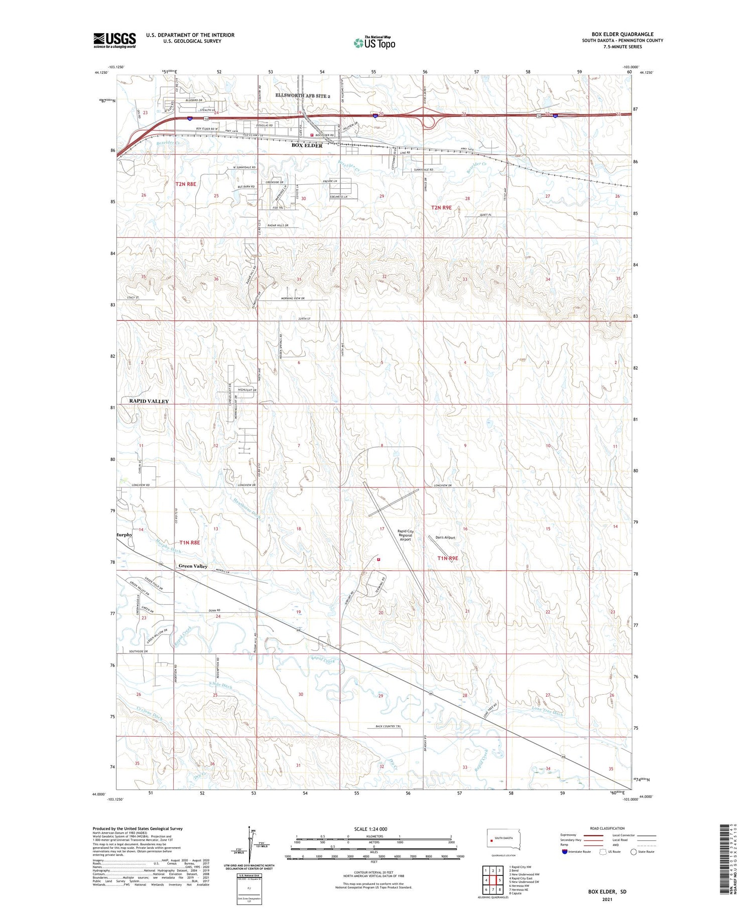
2021 topographic map quadrangle Box Elder in the state of South Dakota. Scale: 1:24000. Based on the newly updated USGS 7.5' US Topo map series, this map is in the following counties: Pennington. The map contains contour data, water features, and other items you are used to seeing on USGS maps, but also has updated roads and other features. This is the next generation of topographic maps. Printed on high-quality waterproof paper with UV fade-resistant inks.
Quads adjacent to this one:
West: Rapid City East
Northwest: Rapid City NW
North: Bend
Northeast: New Underwood NW
East: New Underwood SW
Southeast: Caputa
South: Hermosa NE
Southwest: Hermosa NW
Contains the following named places: Black Hills Life Flight, Box Elder, Box Elder Volunteer Fire Department, City of Box Elder, Dan's Airport, Green Valley, Green Valley Census Designated Place, H O Siding, Lone Tree Ditch, Lone Tree School, Medical Air Rescue Company, Murphy Ditch, Rapid City Fire Department - Station 8, Rapid City Regional Airport, Rapid Valley Census Designated Place, Rapid Valley Community Hall, South Side Ditch, Westjet Air Center, White Eagle School, ZIP Code: 57703


