MyTopo
Hermosa NW South Dakota US Topo Map
Couldn't load pickup availability
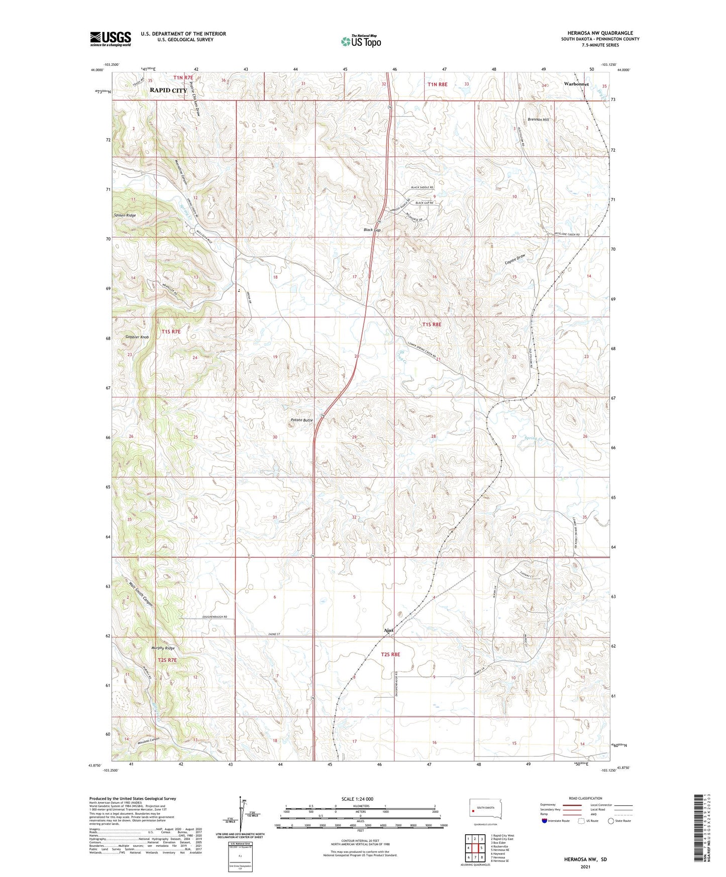
2021 topographic map quadrangle Hermosa NW in the state of South Dakota. Scale: 1:24000. Based on the newly updated USGS 7.5' US Topo map series, this map is in the following counties: Pennington. The map contains contour data, water features, and other items you are used to seeing on USGS maps, but also has updated roads and other features. This is the next generation of topographic maps. Printed on high-quality waterproof paper with UV fade-resistant inks.
Quads adjacent to this one:
West: Rockerville
Northwest: Rapid City West
North: Rapid City East
Northeast: Box Elder
East: Hermosa NE
Southeast: Hermosa SE
South: Hermosa
Southwest: Hayward
This map covers the same area as the classic USGS quad with code o43103h2.
Contains the following named places: Ajax, Black Gap, Brennan Hill, Coyote Draw, Gobbler Knob, Mannhan Canyon, Moonshine Canyon, Murphy Ridge, Neely School, Potato Butte, Prairie Chicken Draw, Rapid City Christian High School, Rapid City Christian Middle School, Spiken Ridge, Walt Smith Canyon, Warbonnet