
MyTopo
Bridgewater West South Dakota US Topo Map
Couldn't load pickup availability
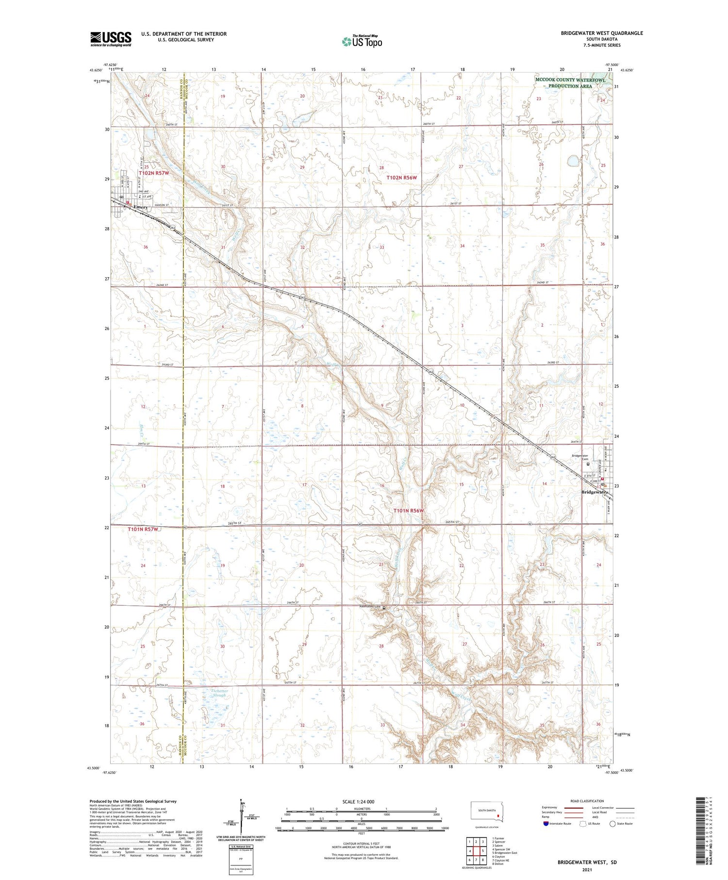
2021 topographic map quadrangle Bridgewater West in the state of South Dakota. Scale: 1:24000. Based on the newly updated USGS 7.5' US Topo map series, this map is in the following counties: McCook, Hanson. The map contains contour data, water features, and other items you are used to seeing on USGS maps, but also has updated roads and other features. This is the next generation of topographic maps. Printed on high-quality waterproof paper with UV fade-resistant inks.
Quads adjacent to this one:
West: Spencer SW
Northwest: Farmer
North: Spencer
Northeast: Salem
East: Bridgewater East
Southeast: Dolton
South: Clayton NE
Southwest: Clayton
Contains the following named places: Bridgewater, Bridgewater Cemetery, Bridgewater City Hall, Bridgewater Community Ambulance, Bridgewater Elementary School, Bridgewater Fire Department, Bridgewater Post Office, Bridgewater-Emery High School, Bridgewater-Emery Middle School, City of Emery, Emery, Emery City Office, Emery City Police Department, Emery Elementary School, Emery Post Office, Emery Volunteer Fire Department, Rasmussen Cemetery, Township of Bridgewater, Tschetter Slough, Tschetter Slough State Public Shooting Area, Waltner & Richards Airport


