MyTopo
Spencer South Dakota US Topo Map
Couldn't load pickup availability
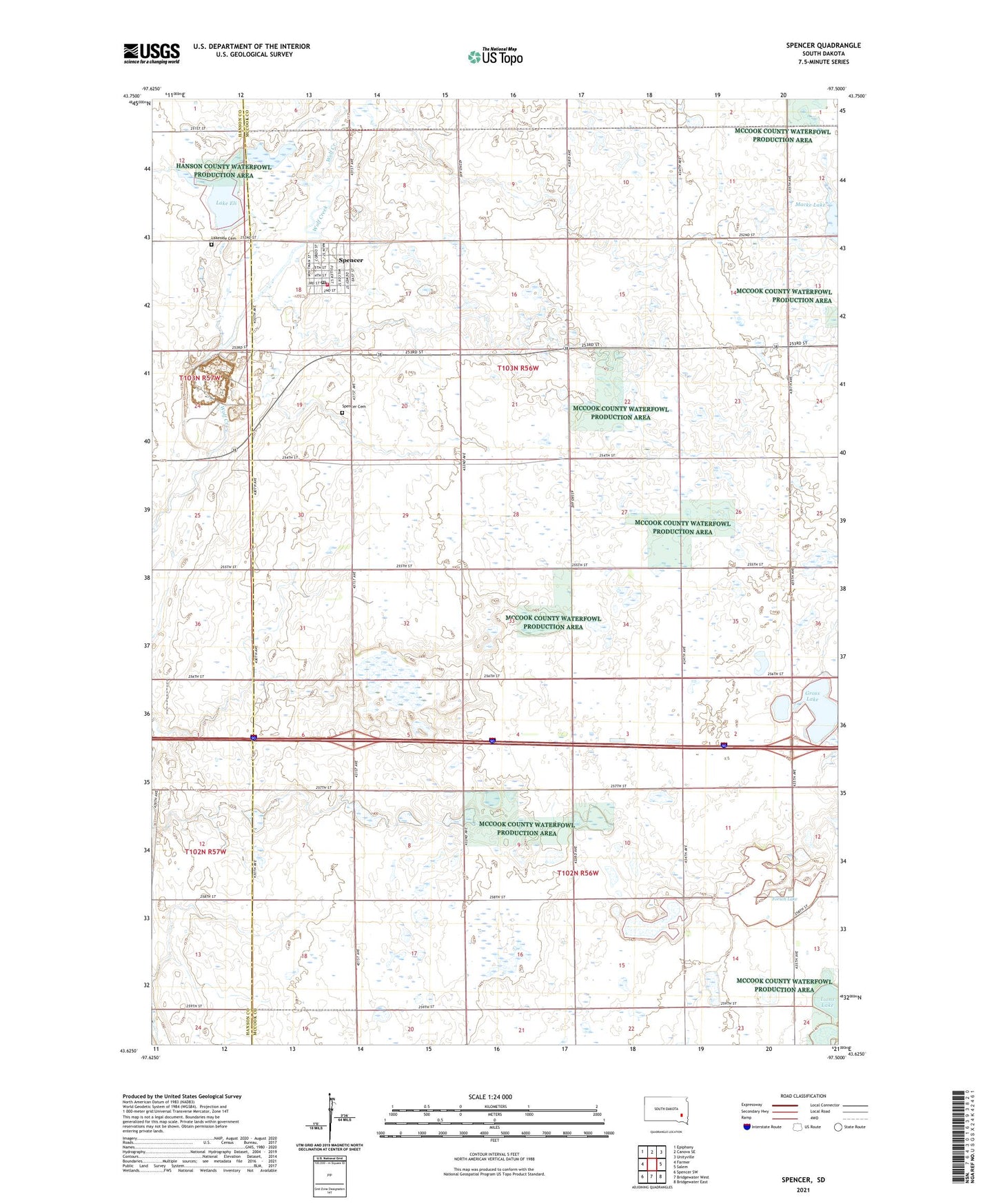
2021 topographic map quadrangle Spencer in the state of South Dakota. Scale: 1:24000. Based on the newly updated USGS 7.5' US Topo map series, this map is in the following counties: McCook, Hanson. The map contains contour data, water features, and other items you are used to seeing on USGS maps, but also has updated roads and other features. This is the next generation of topographic maps. Printed on high-quality waterproof paper with UV fade-resistant inks.
Quads adjacent to this one:
West: Farmer
Northwest: Epiphany
North: Canova SE
Northeast: Unityville
East: Salem
Southeast: Bridgewater East
South: Bridgewater West
Southwest: Spencer SW
This map covers the same area as the classic USGS quad with code o43097f5.
Contains the following named places: City of Spencer, Ediger State Public Shooting Area, Forsch Lake, Forsch Lake State Public Shooting Area, Gross Lake, Gross Lake State Public Shooting Area, Hanson-McCook Regional Library, Lake Eli, Lakeside Cemetery, Lehrman Slough, Lehrman Slough State Public Shooting Area, Lions Lake, Macke Lake, Spencer, Spencer Cemetery, Spencer Fire Department, Spencer Post Office, Township of Benton, Township of Jefferson, Township of Jerrerson