MyTopo
Bridgewater East South Dakota US Topo Map
Couldn't load pickup availability
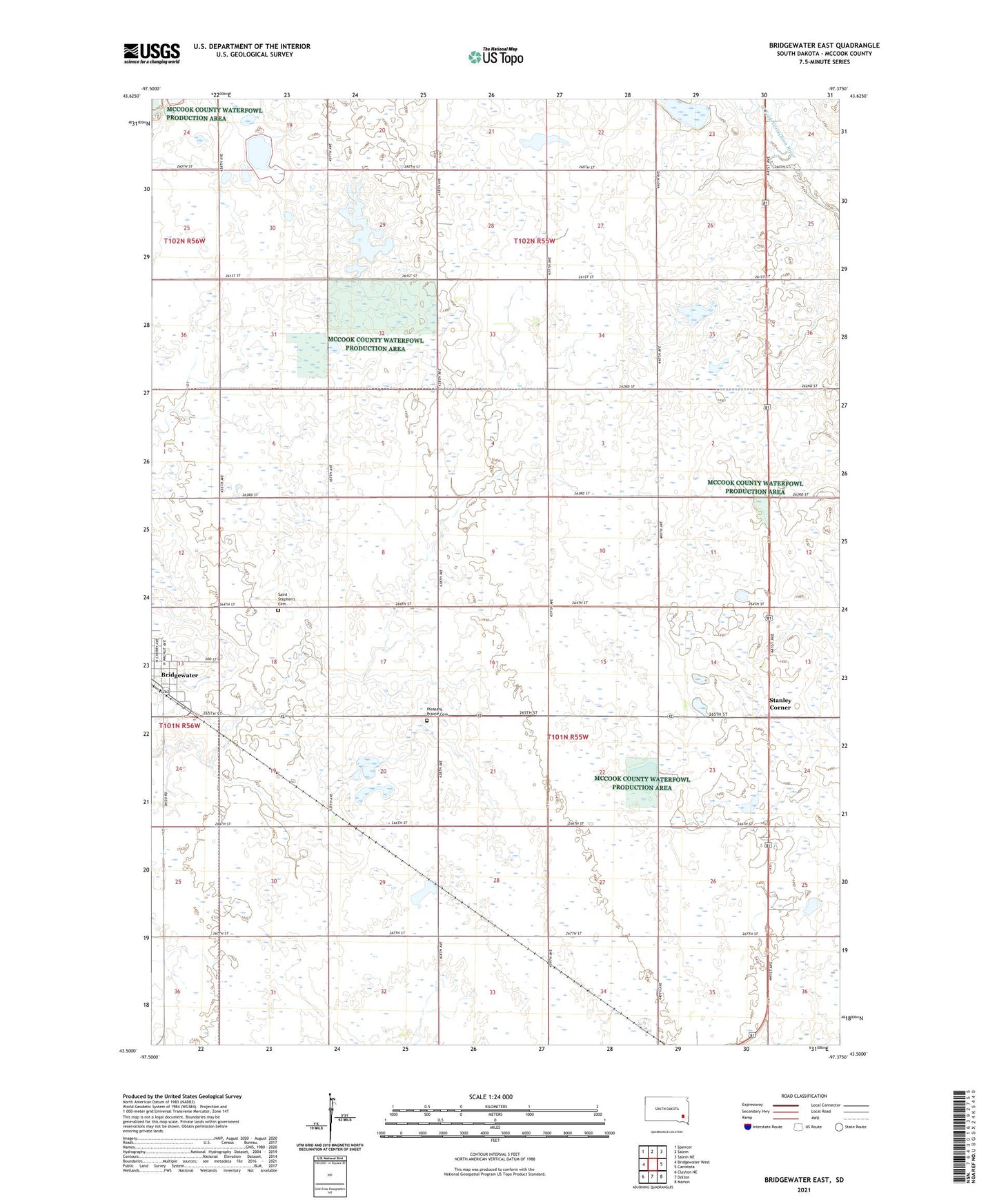
2021 topographic map quadrangle Bridgewater East in the state of South Dakota. Scale: 1:24000. Based on the newly updated USGS 7.5' US Topo map series, this map is in the following counties: McCook, Turner. The map contains contour data, water features, and other items you are used to seeing on USGS maps, but also has updated roads and other features. This is the next generation of topographic maps. Printed on high-quality waterproof paper with UV fade-resistant inks.
Quads adjacent to this one:
West: Bridgewater West
Northwest: Spencer
North: Salem
Northeast: Salem NE
East: Canistota
Southeast: Marion
South: Dolton
Southwest: Clayton NE
This map covers the same area as the classic USGS quad with code o43097e4.
Contains the following named places: City of Bridgewater, McCook County Waterfowl Production Area, Pleasant Prairie Cemetery, Saint Stephen's Cemetery, School Number 3, School Number 4, Stanley Corner, Township of Union, ZIP Code: 57319