MyTopo
Britton East South Dakota US Topo Map
Couldn't load pickup availability
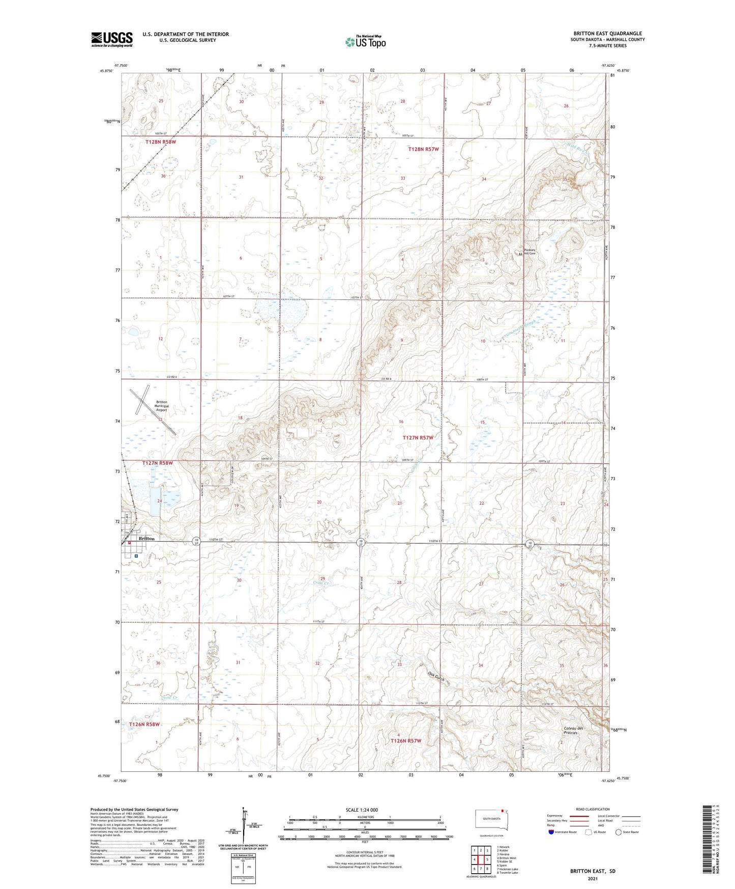
2021 topographic map quadrangle Britton East in the state of South Dakota. Scale: 1:24000. Based on the newly updated USGS 7.5' US Topo map series, this map is in the following counties: Marshall. The map contains contour data, water features, and other items you are used to seeing on USGS maps, but also has updated roads and other features. This is the next generation of topographic maps. Printed on high-quality waterproof paper with UV fade-resistant inks.
Quads adjacent to this one:
West: Britton West
Northeast: Havana
East: Kidder SE
Southeast: Twomile Lake
South: Hickman Lake
Southwest: Spain
This map covers the same area as the classic USGS quad with code o45097g6.
Contains the following named places: Alta, Britton Municipal Airport, Gronseth Slough, Marshall County Ambulance Service, Marshall County Healthcare Center, North Marshall Fire Department, Oak Gulch, Pleasant Hill Cemetery, School Number 1, School Number 2, School Number 3, Township of Pleasant Valley, WRC Flood Control Dam, ZIP Code: 57430