MyTopo
Buffalo South Dakota US Topo Map
Couldn't load pickup availability
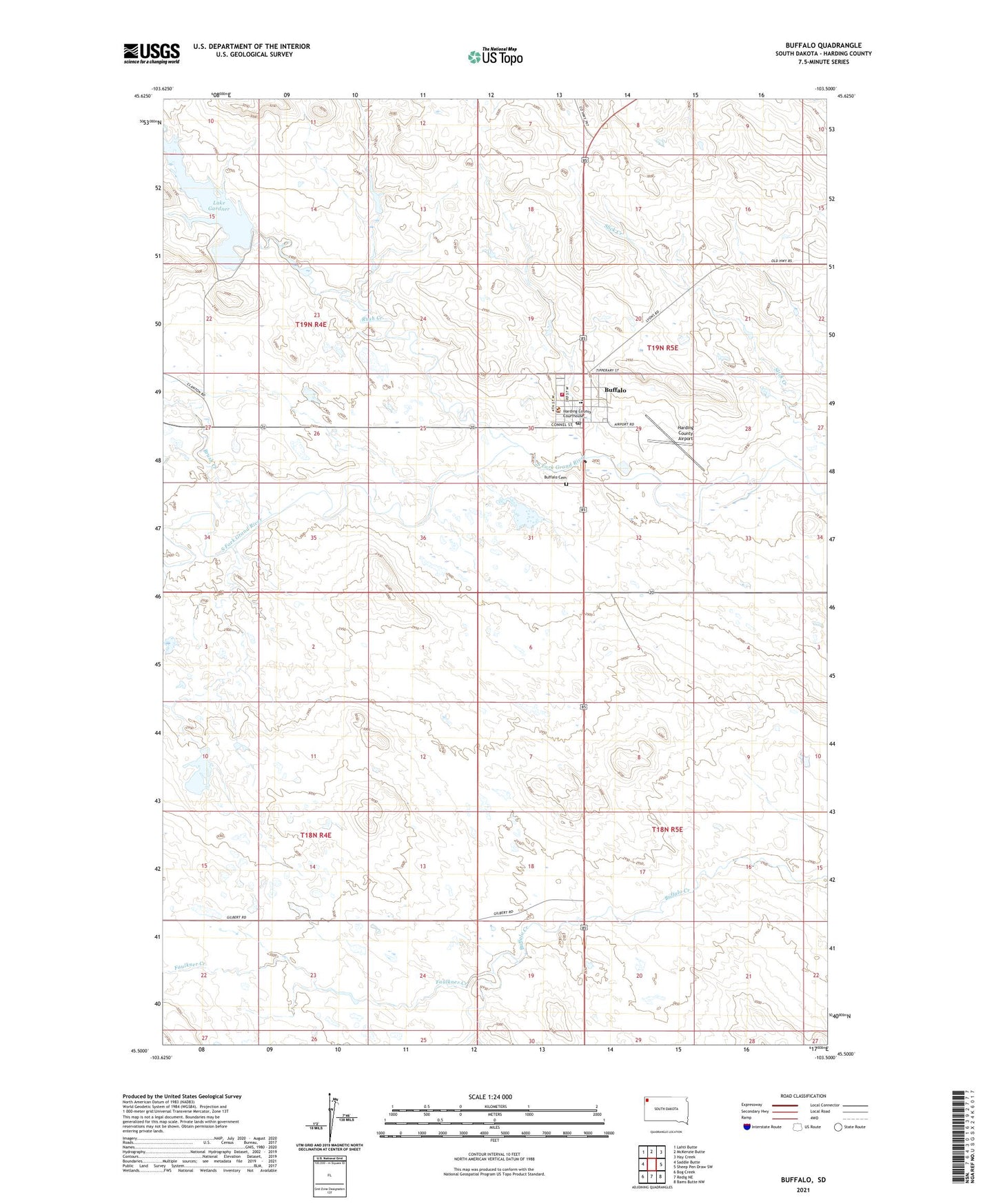
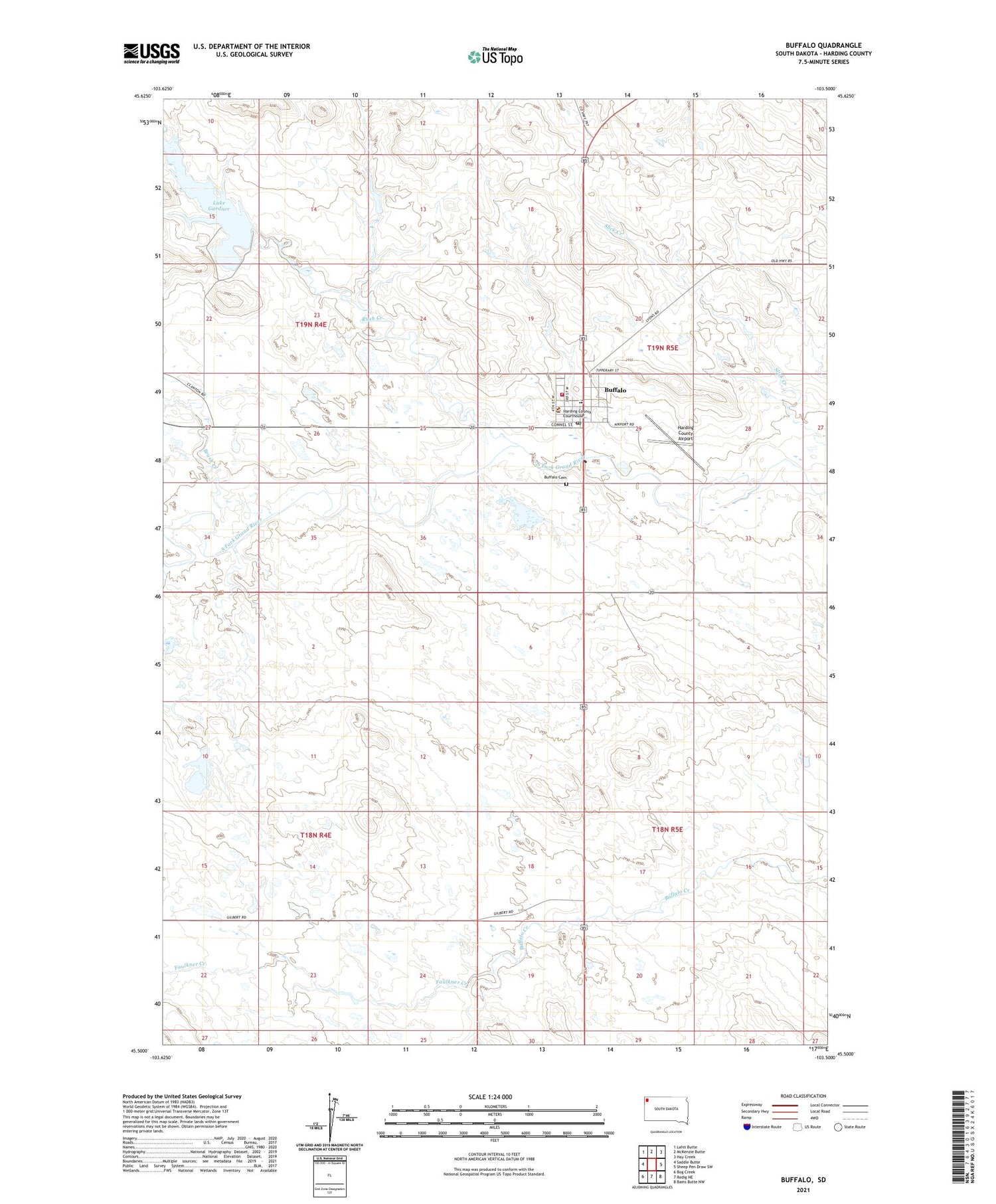
2021 topographic map quadrangle Buffalo in the state of South Dakota. Scale: 1:24000. Based on the newly updated USGS 7.5' US Topo map series, this map is in the following counties: Harding. The map contains contour data, water features, and other items you are used to seeing on USGS maps, but also has updated roads and other features. This is the next generation of topographic maps. Printed on high-quality waterproof paper with UV fade-resistant inks.
Quads adjacent to this one:
West: Saddle Butte
Northwest: Lahti Butte
North: McKenzie Butte
Northeast: Hay Creek
East: Sheep Pen Draw SW
Southeast: Bams Butte NW
South: Redig NE
Southwest: Bog Creek
Contains the following named places: Brush Creek, Buffalo, Buffalo Cemetery, Buffalo Elementary School, Buffalo Police Department, Buffalo Post Office, Buffalo Volunteer Fire Department, Faulkner Creek, Gardner Lake Dam, Harding County Airport, Harding County Ambulance Service, Harding County Courthouse, Harding County High School, Harding County Middle School, Harding County Sheriff's Office, Lake Gardner, Northwest Regional Library, Rush Creek, Salmen Number 1 Dam, Town of Buffalo, Township of Buffalo