MyTopo
Canton SW South Dakota US Topo Map
Couldn't load pickup availability
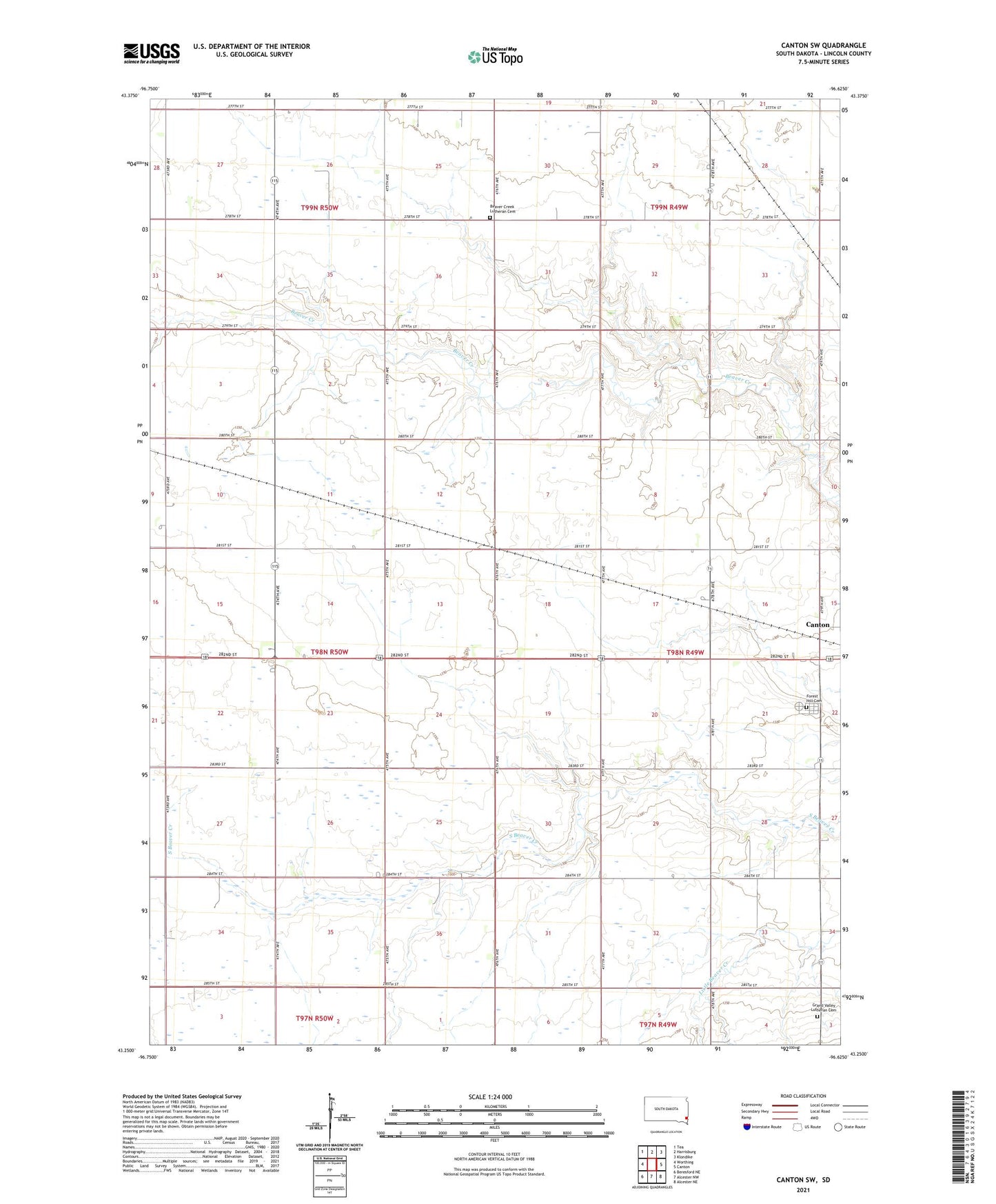
2021 topographic map quadrangle Canton SW in the state of South Dakota. Scale: 1:24000. Based on the newly updated USGS 7.5' US Topo map series, this map is in the following counties: Lincoln. The map contains contour data, water features, and other items you are used to seeing on USGS maps, but also has updated roads and other features. This is the next generation of topographic maps. Printed on high-quality waterproof paper with UV fade-resistant inks.
Quads adjacent to this one:
West: Worthing
Northwest: Tea
North: Harrisburg
Northeast: Klondike
East: Canton
Southeast: Alcester NE
South: Alcester NW
Southwest: Beresford NE
This map covers the same area as the classic USGS quad with code o43096c6.
Contains the following named places: Bailey School, Beaver Creek Church, Beaver Creek Lutheran Cemetery, Forest Hill Cemetery, Grand Valley Church, Grand Valley Lutheran Cemetery, Grand Valley School, Kerley School, KXRB-AM (Canton), Lantaff School, LaValley School, Lincoln County, Prairie Grove School, School Number 56, Sunnyside School, Township of Canton, Township of Lynn, Wiggin School