MyTopo
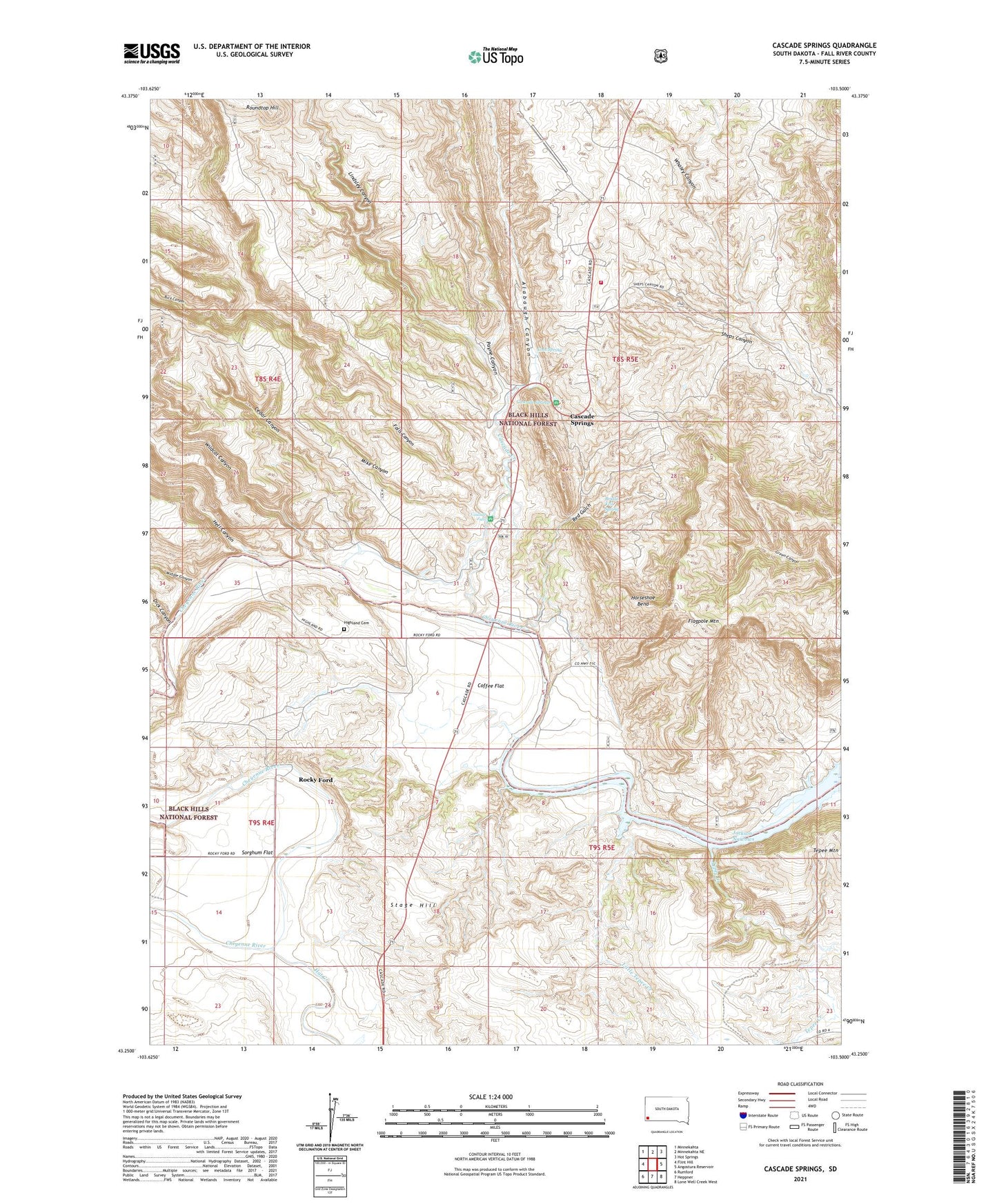
Cascade Springs South Dakota US Topo Map
Couldn't load pickup availability
Also explore the Cascade Springs Forest Service Topo of this same quad for updated USFS data
2021 topographic map quadrangle Cascade Springs in the state of South Dakota. Scale: 1:24000. Based on the newly updated USGS 7.5' US Topo map series, this map is in the following counties: Fall River. The map contains contour data, water features, and other items you are used to seeing on USGS maps, but also has updated roads and other features. This is the next generation of topographic maps. Printed on high-quality waterproof paper with UV fade-resistant inks.
Quads adjacent to this one:
West: Flint Hill
Northwest: Minnekahta
North: Minnekahta NE
Northeast: Hot Springs
East: Angostura Reservoir
Southeast: Lone Well Creek West
South: Heppner
Southwest: Rumford
This map covers the same area as the classic USGS quad with code o43103c5.
Contains the following named places: Alabaugh Canyon, Brainerd Indian Training School, Bridal Veil Spring, Buck Canyon, Cascade Creek, Cascade Falls, Cascade Fire Department, Cascade Springs, Cedar Canyon, Coffee Flat, Coffee Flat School, Cool Spring, Dick Canyon, Fairview School, Falls Canyon, Flagpole Mountain, Hat Creek, Hell Canyon, Highland Cemetery, Horseshoe Bend, J H Keith Memorial Picnic Area, Jackson Narrows, Lindsley Canyon, Little Tepee Creek, Middle Canyon, Mike Canyon, Miller Cabin, Payne Canyon, Red Gulch, Rocky Ford, Roundtop Hill, Sheps Canyon School, Sorghum Flat, Stage Hill, Tepee Creek, Whaley Canyon, Wildcat Canyon