MyTopo
Centerville South Dakota US Topo Map
Couldn't load pickup availability
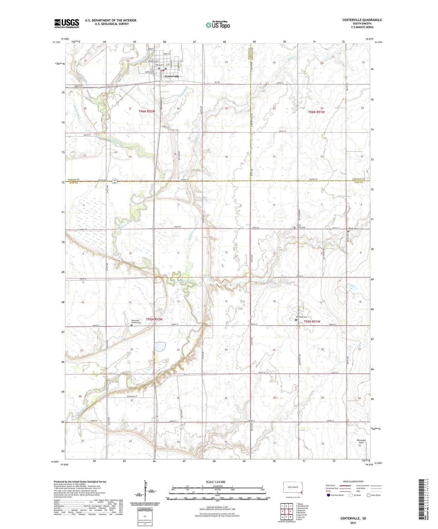
2021 topographic map quadrangle Centerville in the state of South Dakota. Scale: 1:24000. Based on the newly updated USGS 7.5' US Topo map series, this map is in the following counties: Clay, Turner, Lincoln. The map contains contour data, water features, and other items you are used to seeing on USGS maps, but also has updated roads and other features. This is the next generation of topographic maps. Printed on high-quality waterproof paper with UV fade-resistant inks.
Quads adjacent to this one:
West: Wakonda
Northwest: Viborg
North: Beresford NW
Northeast: Beresford NE
East: Beresford
Southeast: Alsen
South: Hub City
Southwest: Gayville NE
Contains the following named places: Ash Creek, Ash Creek School, Bixler Ridge Airport, Blind Creek, Bonine Ditch, Centerville, Centerville City Hall, Centerville Community Ambulance Service, Centerville Community Library, Centerville Elementary School, Centerville Fire Department, Centerville High School, Centerville Junior High School, Centerville Police Department, Centerville Post Office, City of Centerville, Hovde Cemetery, Joy School, Komstad, Komstad Cemetery, Komstad Church, Komstad School Number 46, Noble Ditch, North Riverside School, Riverside - Barton Cemetery, Saint Johns Cemetery, Township of Riverside, Turkey Ridge Creek, Ward Airfield, ZIP Code: 57014