MyTopo
Hub City South Dakota US Topo Map
Couldn't load pickup availability
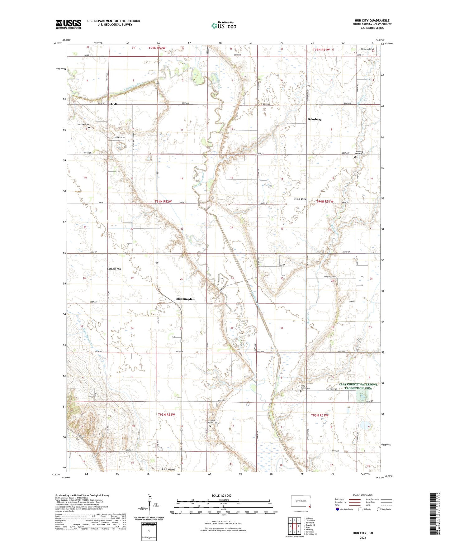
2021 topographic map quadrangle Hub City in the state of South Dakota. Scale: 1:24000. Based on the newly updated USGS 7.5' US Topo map series, this map is in the following counties: Clay. The map contains contour data, water features, and other items you are used to seeing on USGS maps, but also has updated roads and other features. This is the next generation of topographic maps. Printed on high-quality waterproof paper with UV fade-resistant inks.
Quads adjacent to this one:
West: Gayville NE
Northwest: Wakonda
North: Centerville
Northeast: Beresford
East: Alsen
Southeast: Vermillion SE
South: Vermillion
Southwest: Meckling
This map covers the same area as the classic USGS quad with code o42096h8.
Contains the following named places: Alson, Baptist Creek, Bloomingdale, Bloomingdale Methodist Church, Cabbage Flat, Clay County, Clay County Waterfowl Production Area, Clay Point, Clay Point Cemetery, Dalesburg, Dalesburg Baptist Cemetery, Dalesburg Church, Dalesburg School, Garfield Tabernacle, Glenwood Field, Hub City, Lake Como, Lake Emeline, Lodi, Lodi Airport, Marshalltown, Marshalltown School, Old Lodi Cemetery, Pleasant Dell School, Spirit Mound Cemetery, Township of Pleasant Valley