MyTopo
Beresford South Dakota US Topo Map
Couldn't load pickup availability
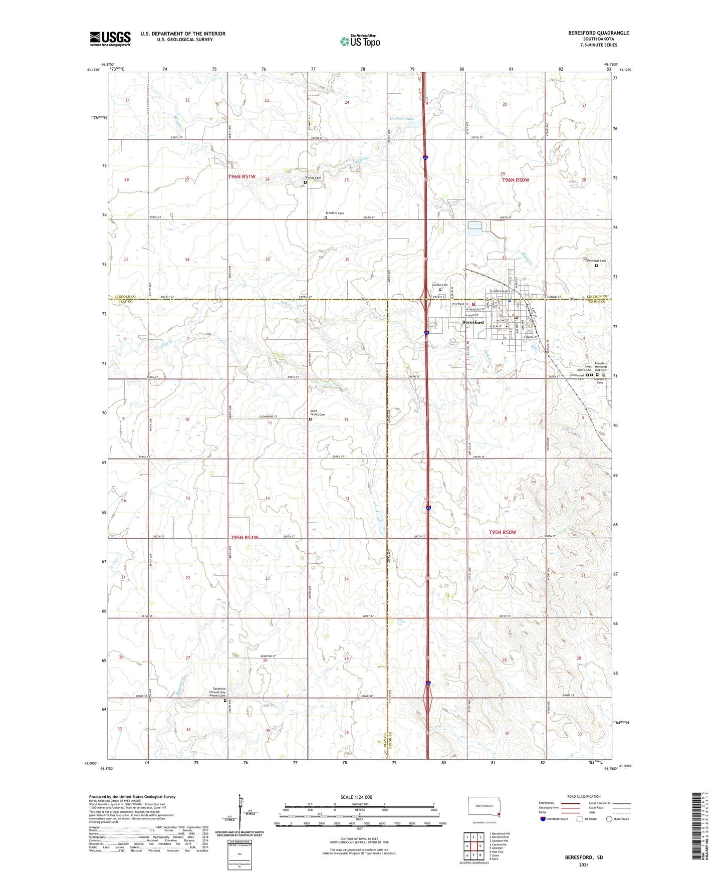
2021 topographic map quadrangle Beresford in the state of South Dakota. Scale: 1:24000. Based on the newly updated USGS 7.5' US Topo map series, this map is in the following counties: Clay, Union, Lincoln. The map contains contour data, water features, and other items you are used to seeing on USGS maps, but also has updated roads and other features. This is the next generation of topographic maps. Printed on high-quality waterproof paper with UV fade-resistant inks.
Quads adjacent to this one:
West: Centerville
Northwest: Beresford NW
North: Beresford NE
Northeast: Alcester NW
East: Alcester
Southeast: Nora
South: Alsen
Southwest: Hub City
This map covers the same area as the classic USGS quad with code o43096a7.
Contains the following named places: Beresford, Beresford Cemetery, Beresford City Hall, Beresford Community Ambulance Service, Beresford Elementary School, Beresford Fire Department, Beresford High School, Beresford Memorial Park Cemetery, Beresford Middle School, Beresford Police Department, Beresford Post Office, Beresford Public Library, Bethesda Cemetery, Bethesda Homes, Bonine Cemetery, Brooklyn, Brooklyn Cemetery, Brooklyn Church, Brooklyn School, Canton Dam, Carlson Lake, City of Beresford, Danefield School, Danefield Seventh Day Advent Cemetery, Emmanuel Lutheran Cemetery, Glenwood, Glenwood School, Houde Cemetery, Klostergaard Dam, Larsen Cemetery, Saint John's Cemetery, Saint Peters Cemetery, Seventh Day Adventist Church, Stewart Dam, Sunnyside School, Township of Glenwood, ZIP Code: 57004