MyTopo
Chamberlain South Dakota US Topo Map
Couldn't load pickup availability
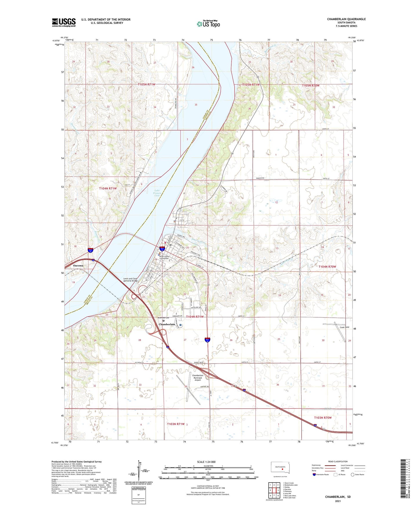
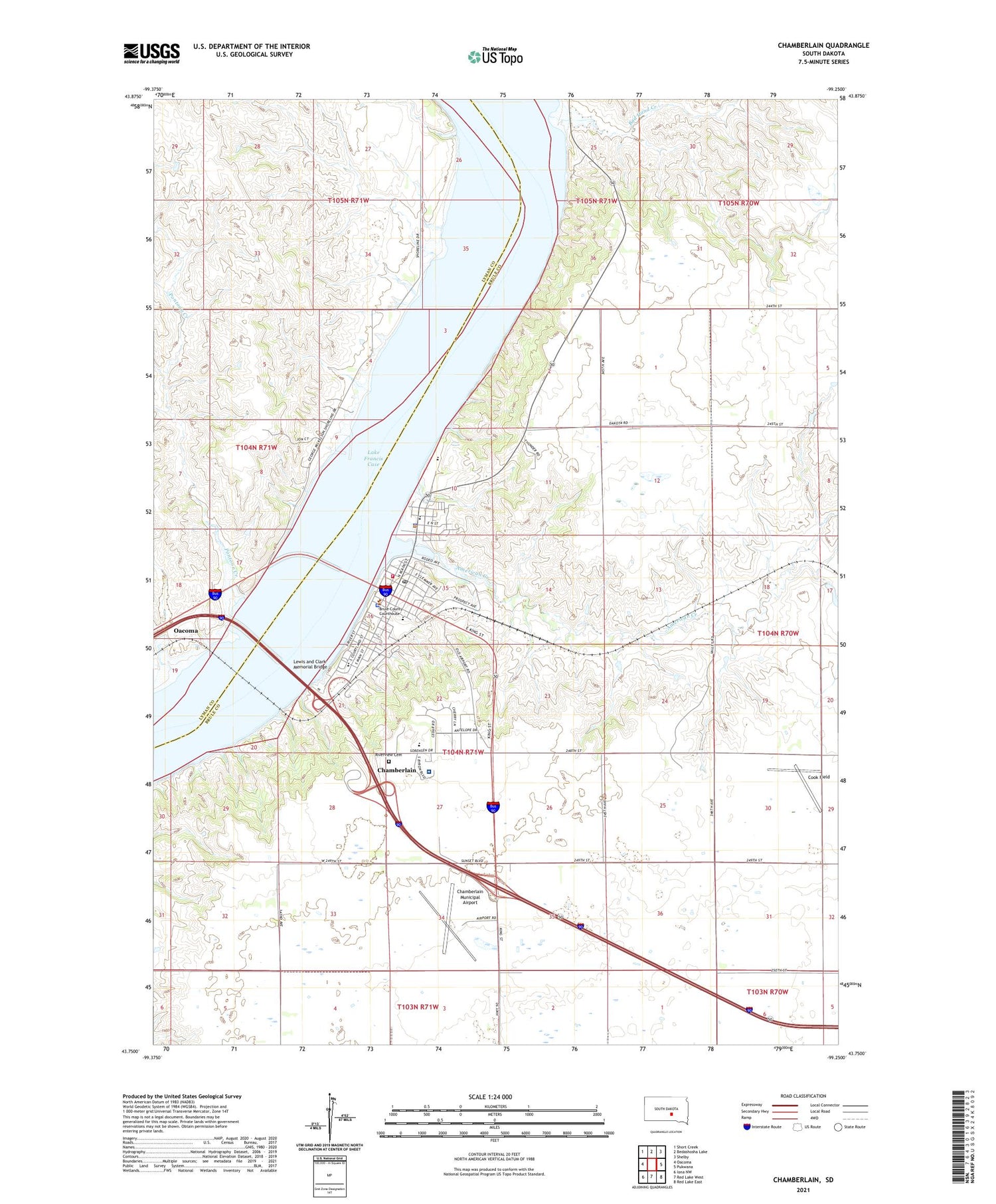
2021 topographic map quadrangle Chamberlain in the state of South Dakota. Scale: 1:24000. Based on the newly updated USGS 7.5' US Topo map series, this map is in the following counties: Brule, Lyman. The map contains contour data, water features, and other items you are used to seeing on USGS maps, but also has updated roads and other features. This is the next generation of topographic maps. Printed on high-quality waterproof paper with UV fade-resistant inks.
Quads adjacent to this one:
West: Oacoma
Northwest: Short Creek
North: Bedashosha Lake
Northeast: Shelby
East: Pukwana
Southeast: Red Lake East
South: Red Lake West
Southwest: Iona NW
Contains the following named places: Akta Lakota Museum, American Creek, American Creek Recreation Area, American Island, Bad Hand Creek, Brule County Courthouse, Brule County Sheriff, Chamberlain, Chamberlain Academy HIgh School, Chamberlain Academy Middle School, Chamberlain City Hall, Chamberlain Elementary School, Chamberlain Fire Department, Chamberlain High School, Chamberlain Junior High School, Chamberlain Municipal Airport, Chamberlain Post Office, Chamberlain Recreation Area, City of Chamberlain, Cook Field, Cozard Memorial Library, Feltman Dam 1, Fort Lookout, Fort Recovery, Lewis and Clark Memorial Bridge, Lyman Post Office, Missouri Valley Ambulance Service, Pontoon Creek, Riverview Cemetery, Saint Josephs Indian School, Sanford Mid - Dakota Medical Center, Speckels Dam, Town of Oacoma, Township of Chamberlain, ZIP Code: 57325