MyTopo
Shelby South Dakota US Topo Map
Couldn't load pickup availability
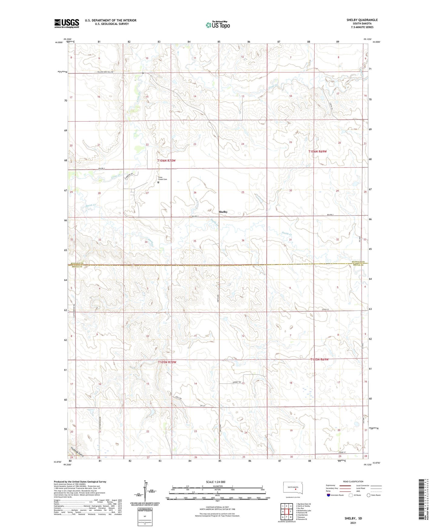
2021 topographic map quadrangle Shelby in the state of South Dakota. Scale: 1:24000. Based on the newly updated USGS 7.5' US Topo map series, this map is in the following counties: Buffalo, Brule. The map contains contour data, water features, and other items you are used to seeing on USGS maps, but also has updated roads and other features. This is the next generation of topographic maps. Printed on high-quality waterproof paper with UV fade-resistant inks.
Quads adjacent to this one:
West: Bedashosha Lake
Northwest: Big Bend Dam SE
North: North of Shelby
Northeast: Dry Run
East: Pukwana NE
Southeast: Pukwana SE
South: Pukwana
Southwest: Chamberlain
This map covers the same area as the classic USGS quad with code o43099h2.
Contains the following named places: Coolidge School, Crow Creek, Crow Creek Cemetery, Crow Creek Church, Disseau Dam 2, Elm Creek, Gearhart School, Larson Dam, Mayer Dam, Olson School, Saint Peters Mission, Schaub Dam, Shelby, Smith Creek, Stroud School, Turgeon Dam